The following is a photo essay from last weekend’s adventure on the Pacific Crest Trail.
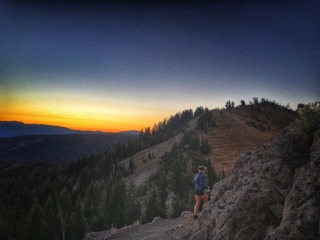
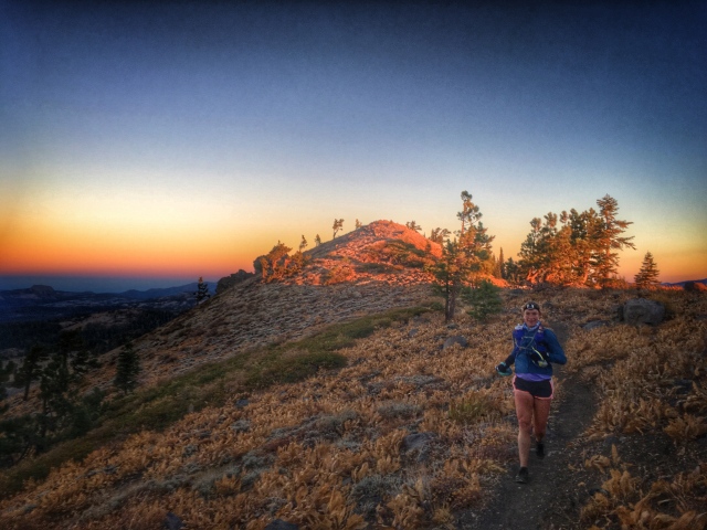
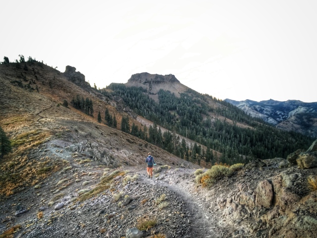
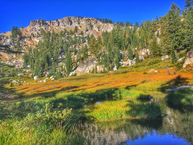
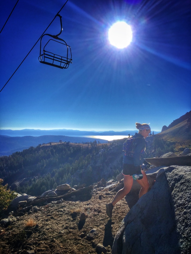
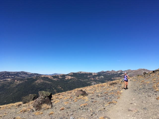
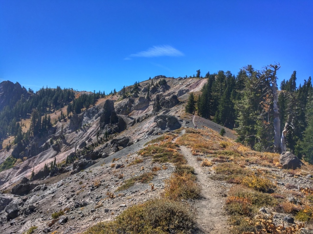
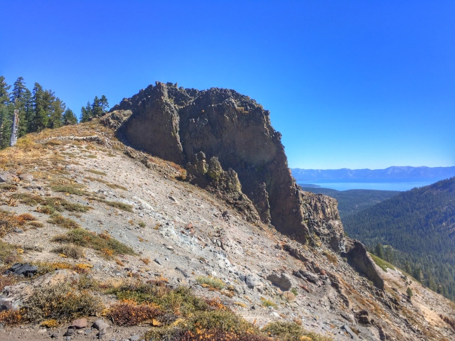
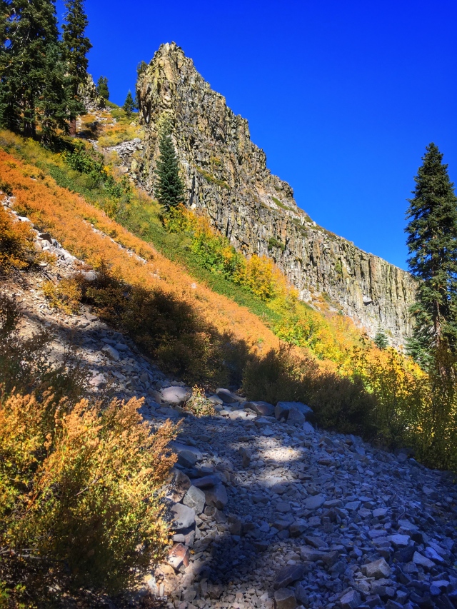
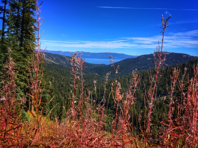
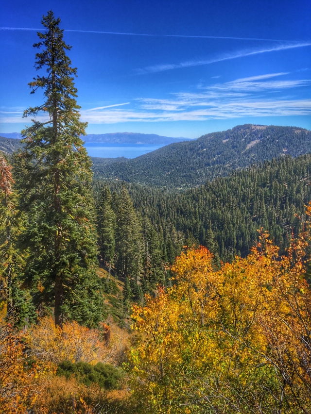
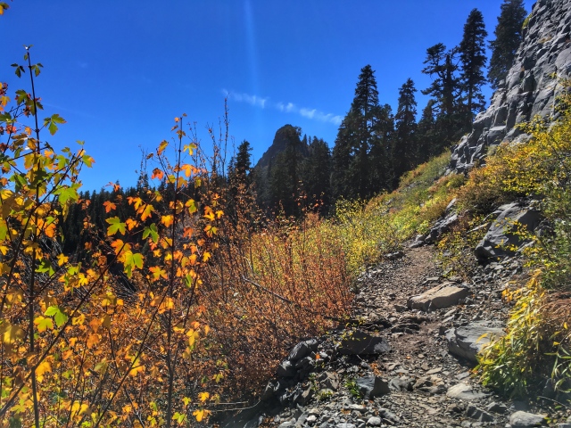
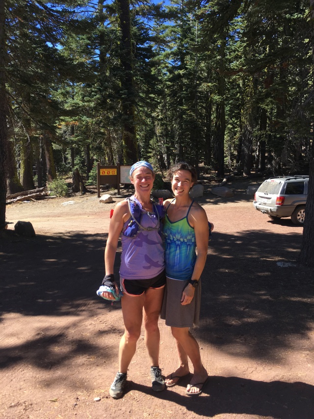
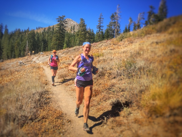
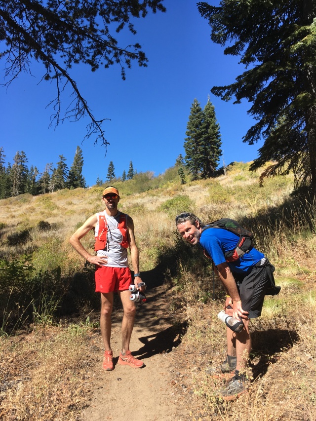
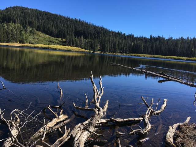
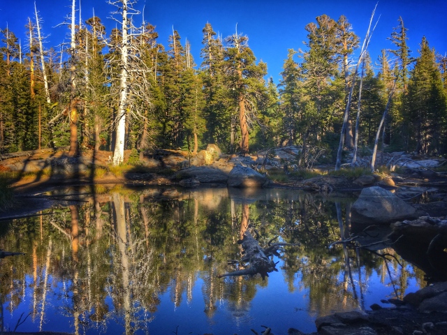
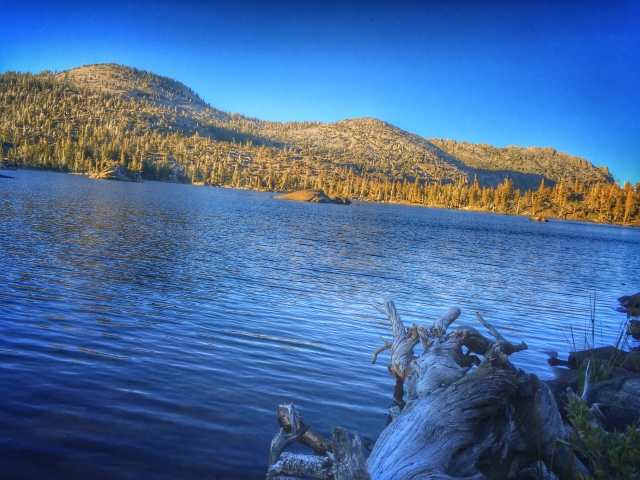
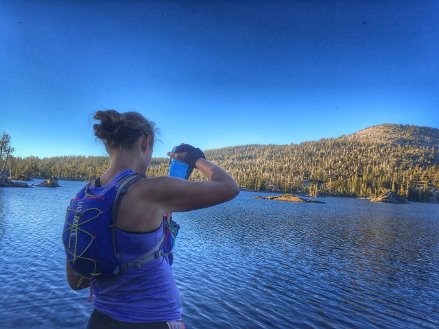
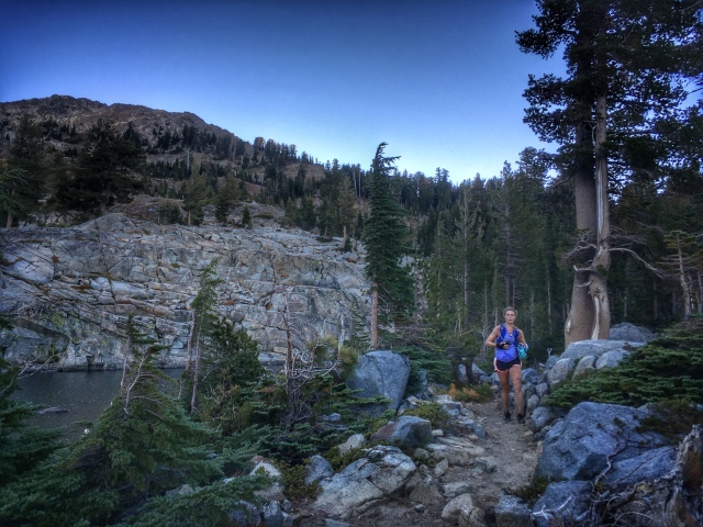
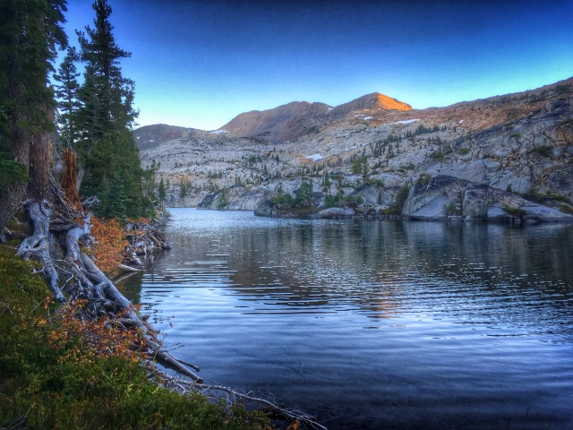
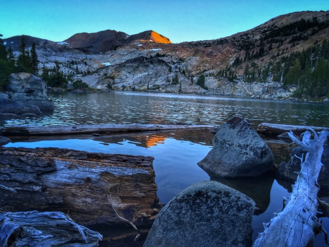
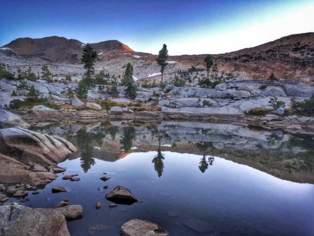
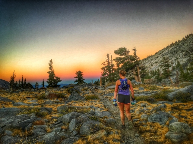
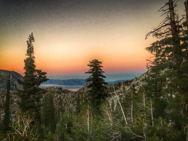
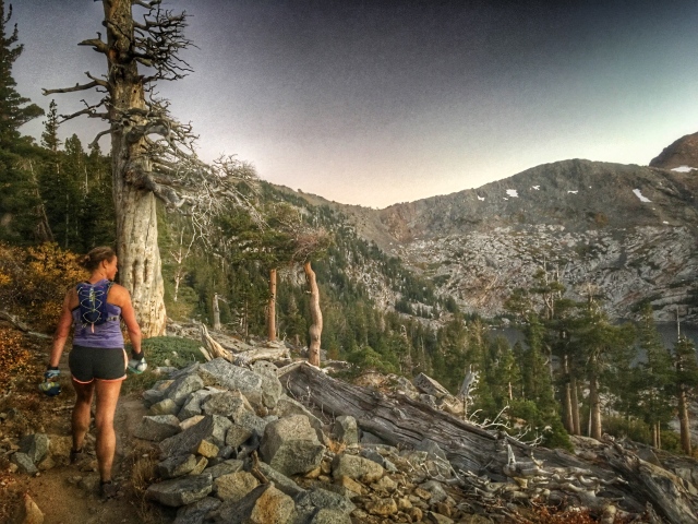
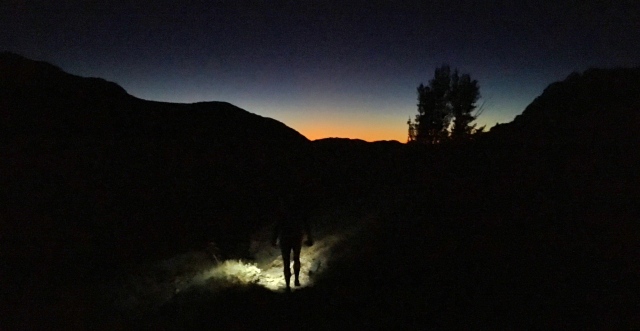
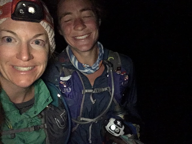
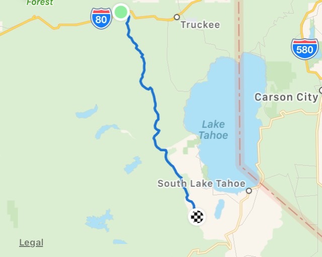
We set out at 4:15am from the Pacific Crest Trailhead near Boreal in Truckee, CA. The goal was to complete [what we thought would be] 60 miles of trail down to Hwy 50 in South Lake Tahoe. Our estimated time was 16-17 hours, with a worst-case scenario of 18 hours. Stacie Riddle, Kathy D’Onofrio and I happily chatted in the dark for two hours, before Kathy turned around at Mt. Lincoln. She had just finished the Tahoe 200 (2nd female!) less than two weeks earlier, and only joined us for the first part. Stacie and I continued on to witness a beautiful sunrise on the ridgeline between Mt. Lincoln and Anderson Peak.Stacie, who ran her first 100 mile race one week before, the Kodiak 100 (which was “easy”). I wasn’t sure if she’d be ready for this kind of mileage, until I peeked at her Strava account and saw she already put in over 70 miles Monday-Thursday. Um, yeah, she was ready.Stacie running towards Anderson Peak, with views of the ridge we would be on in about 20 miles in the distance. Best not to think too far ahead though.Me, on the other side of Tinker’s Knob. No pics from the ridge because the winds were so insane. Happy to be out of the cold in this pic.Dropping into Granite Chief Wilderness in SquawStacie climbing under the Granite Chief chairlift, with Lake Tahoe reflecting the morning sunStacie running South on the PCT on the backside of Alpine MeadowsThe ridgeline between Alpine Meadows and before Barker was spectacular. Every bend in the trail offered another sweeping, breathtaking view.More views of the ridgeline with Lake Tahoe in the background. This is still on the PCT, a few miles before it merges with the Tahoe Rim Trail.I was surprised at how beautiful the section between Alpine Meadows and Barker Pass is – it was one of my favorite parts. Which was good, because this is where we realized that it wasn’t only 30 miles from I-80 to Barker Pass, it was going to be more like 33.5. Foolishly, I initially thought this must mean we were more than halfway – and it was only 26.5 miles to Hwy 50. Um, No.Fall colors on the climb up to Barker Pass.Barker Pass viewsFall colors in Tahoe on the PCT/TRTAt Barker Pass, about mile 33.5, we spent about 30 minutes hanging out with Helen Pelster, who ran the IMTUF 107 mile race the weekend prior (3rd female and 3rd fastest female time on the course). She brought my cooler with coke, water, and some food I had prepared before the run. Stacie and I were very happy to hear we had “beat” the boys, who started from the opposite end of our run, Hwy 50 in South Lake Tahoe. Sure, they started 2 hours before us, but we still thought they might beat us to the halfway point.Stacie and I leaving Barker Pass, over 9.5 hours into our run, ready for the 2nd half of our journey. Photo by Helen PelsterWe found the boys! Peter Fain and Paul Sweeney, who proclaimed it was a lot slower going from Hwy 50 to Barker than it was going South – it took them a full hour longer than a previous Barker-to-50 run on the trail. We took this as a good sign – we had it the easy way! Unfortunately, they also let us know that it was another 33.5 or so miles to Hwy 50 – yikes! Just as we were heading down the trail, the boys said “oh yeah, about your car… it’s not parked at Echo Lake. Go up the PCT another mile, and after you cross this crazy raging river, head left, and you’ll see the car” – we were too happy and high on endorphins at this point to really understand what they were saying. Raging river? what? must be joking. Shortly after we left them, we saw Jesse Wifely, who would join Peter at Barker to continue on to I-80. The rest of the run, they were on my mind – where were they? How long would it take them? Were they home in bed before we finished?The section from Barker Pass until the Meeks Bay turnoff was my least favorite. Too many trees and not enough grandiose views, in my opinion. It dragged on forever. And Stacie kept promising that any minute we would be out on the granite and back on the ridges – she lied. Here’s a boring lake that I stopped at to filter water.We finally passed the turnoff to Meeks Bay, and started seeing rocks instead of just trees. The terrain became significantly more beautiful.Stacie had remembered a lake near the trail – we were just about out of water, but passed by a couple streams anticipating the lake. We then found ourselves high above the lake we thought we needed, so we had to add an out and back, down and up, to our route.We saw several people camping here – preparing dinner, drinking wine, hanging out in warm puffy jackets. I was kind of dying inside, knowing that we still had 25 ish miles to go, and the going was starting to get tough.
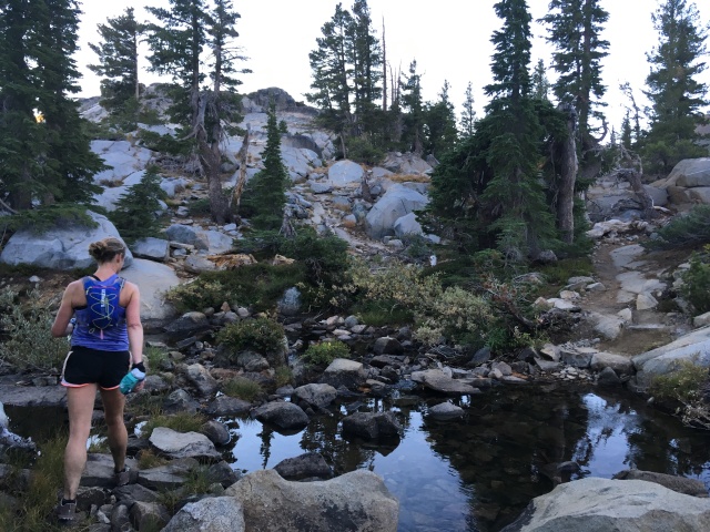
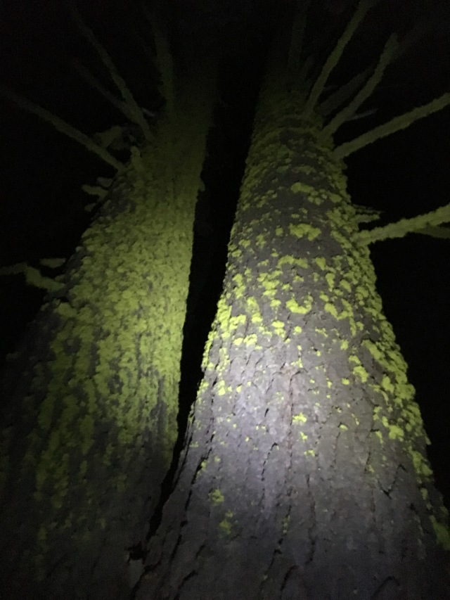
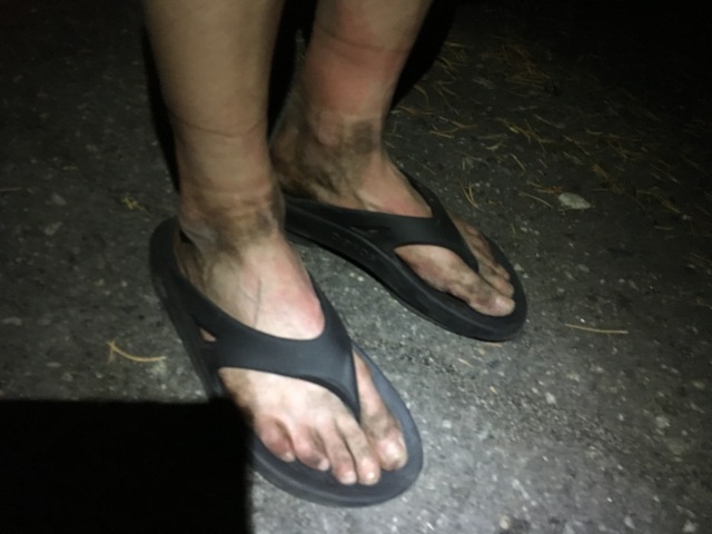
Filling our bottles with the Sawyer Mini filter. There was plenty of water to make it with about 2L carrying capacity and filtering more along the way.The miles became harder as we headed further into Desolation Wilderness
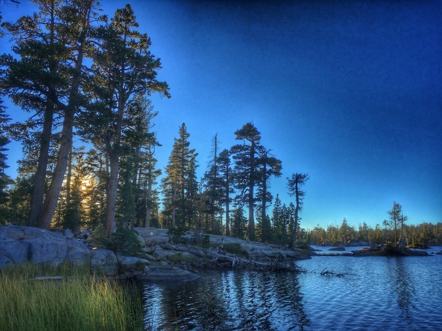
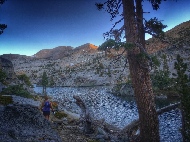
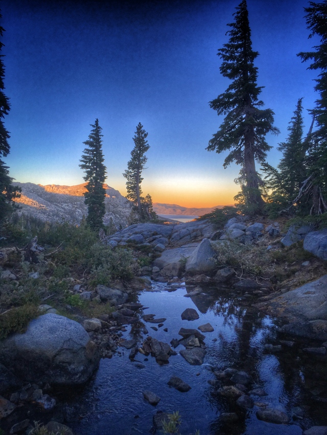
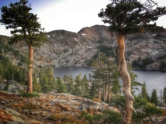
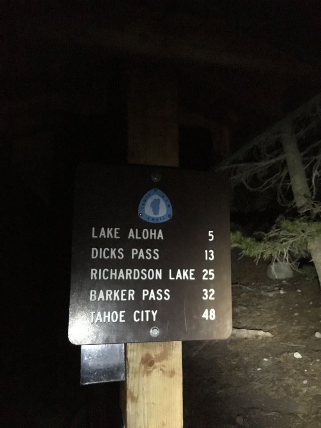
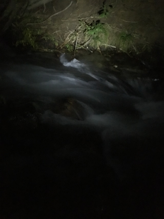
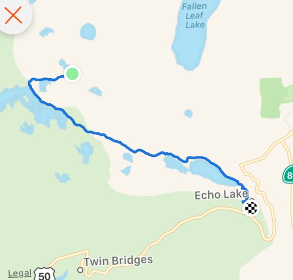
The lakes in Desolation are over the top incredible.Stacie heading into the sunsetSunset over Emerald BayI felt pretty grateful to see both the sunrise and the sunset from the PCT in one day. I wasn’t feeling especially grateful that we still had 20 miles to go.After about the 20th time I asked; Yes, we were finally heading up towards Dick’s PassDick’s Lake. Just before we reached the high point of Dick’s Pass, it became dark enough to get out our headlamps and put the warmer layers back on. It felt kind of crazy to start out the day running in 30 degree weather, then have it warm up to 80 degrees, and then drop back down to the 30s at night. Such is fall in Tahoe.Stacie coming down from Dick’s Pass into the darkness. As the miles barely crept by, it became exceedingly difficult not to get discouraged and negative. My watch stopped when we hit 17 hours and 56.9 miles. At the least, we had 10 miles to go, which could take 5 more hours at this pace. An hour passed and I asked Stacie how far we’d gone now and she said 58.5 miles. Typically I never sit down during long runs, but now, I started sitting each time we stopped. Why not? We were barely moving. We might just fall asleep and die out here. I thought about how I only had 250 calories left for 4-5 hours. I reassured myself that I had plenty of reserves to survive, to settle the panic.As much as I was ready to be done (for the last 6 hours I was ready to be done), I still appreciated the beauty of the trail at night, and was entertained by the little illusions and tricks my eyes were playing on me. At one point, I had sat down to filter water and told Stacie to go ahead. As I jogged to catch up to her, I suddenly stopped, terrified at the cliff I was about to jut out on. I yelled “Stacie!! Stacie!!” There was no f-ing way I was going out on the edge of a cliff at this hour, feeling this crappy. I stopped. I’m going the other way. Just as I started back on the trail in the opposite direction I shined my light over the cliff (against my better judgement) and realized it was just a pond. There was no cliff. It was the blackness of a little lake that looked like a dropoff. I nervously laughed and caught up to Stacie. I can’t believe I had almost turned around and ran the wrong direction. I wanted to cry when I saw her.I had no idea how freaking L-O-N-G the trail was between Echo Lake and Lake Aloha. “5 miles” does not do it justice. The sign should instead say, “2 hours of HELL”. One of our favorite parts was seeing the sign that said we were “Now Leaving Desolation Wilderness” Thank F-ing God. Along the way, we had been so excited to get to freaking Echo Lake. Now that we were here, we wondered out loud why in the hell did the boys park my car another mile up the trail, and not in one of these perfectly good, comfortable and happy parking lots near Echo Lake? We begrudgingly started UP the trail from the parking lot towards Hwy 50.After what seemed like forever, around 1:00AM, we finally heard the sounds of the river the boys had mentioned. It sounded like Niagara Falls. We got to the bank of the river and our conversation contained a lot of “What the fuck were they thinking?? There is no way we are going to get across this thing! WTF!?” I finally decided we should get some big sticks to self-arrest in case we were swept down. I told my plan to Stacie and she said “no way am I getting in that water, I’m crossing the log”. I looked up the river at the log perched about 5-6 feet above the raging river. I felt like I was in Bridge to Terabithia. I volunteered to go first – because the only thing worse than falling yourself is watching your friend fall. I had to be brave (totally against my nature here). I crossed with faked confidence. Then I had to watch Stacie cross – completely gripped. When she made it we hugged and yelped. We then wandered through the forest, a little neighborhood, and right around 1:15am when I was about to dial Peter and ask “where the f is my car” we saw it. It was the happiest moment of my life. (that I remember anyway).We made it!! 21 f-ing hours!! Stacie’s watch and phone combo came up with 66.6 miles. Mine added up to 67.8. I’ll call it 68.My feet felt like I’d just run 100 miles. In many ways, this effort was much harder than any 100 mile race I had run. During races, you go from aid station to aid station, with at most, 6-8 miles in between. There are other runners and camaraderie on the trail. Out here, it was just Stacie and I, and a smattering of hikers cozy in their tents, not offering us a beer or anything. On the 90 minute drive back to Truckee, while eating BBQ chips and drinking full-fat chocolate milk, we discussed our adventure. We both agreed this was the “most epic thing” we had ever done. During the run, 20 hours earlier, we had laughed about someone using that term – now we had a legit use for it. We had done it. 68 (or whatever) miles in one day. And we decided we were glad the boys made us cross that fucking raging river at the finish. It just added to the adventure.The first section, Hwy 80 to just under Dick’s Pass. Hours 1-17, 56.9 milesHours 17-21. Darkness. Despair. and ultimately… Joy. 10.9 miles
We later (Sunday night) found out the boys had all stopped at Barker Pass. Even though they were capable of running the entire thing at least 7 HOURS faster than us, on this particular day, considering we were the only ones who “finished”, we beat the boys. 😉
I’d like to thank Peter for putting this crazy idea into my head a few days ago, when I mentioned I wanted to do a 40 mile run somewhere (he said what’s 20 more?!), Stacie for being an amazingly fun and positive companion on the trail, Kathy for sharing the first 6 miles with us, Helen for being the best friend ever to give up most of her Saturday to cater to us at 7,700′, Julia for kicking ass at The Bear and then texting with me for company on my way down to Echo Lake (and celebrating with me on Sunday), and Lucas for the support throughout the endeavor from across the Atlantic. XO
Congrats on such a beautiful and demanding run!!!What a way to spend a glorious fall day (and night). Beautiful shots of your journey!! Btw — Helen has advised me WTF = “where’s the finish?”
Great adventure, truly epic and yes, you did beat us, totally beat us. That extra mile made it the true interstate 80 to highway 50 stretch. Well done.
Nelly, great story. I was thinking about going for a run in the woods this weekend but after reading this story I think that I’ll just curl up on the couch around a six-pack and watch Chariots of Fire.

AMAZING!
LikeLike
Thanks, Jeff! Great to see you Friday!
LikeLike
Congrats on such a beautiful and demanding run!!!What a way to spend a glorious fall day (and night). Beautiful shots of your journey!! Btw — Helen has advised me WTF = “where’s the finish?”
LikeLike
Thank you so much, Carol!! It was so gorgeous. What a journey!
LikeLike
This is so awesome. I’m proud of you all! (I’ve ran to Barker from 80 & ran from Echo to Barker, but never the whole stretch at once. I must!)
LikeLike
Thanks, Elke! I will let you know when we do it again. Thinking 50 to 80 next time. 🙂
LikeLike
Great adventure, truly epic and yes, you did beat us, totally beat us. That extra mile made it the true interstate 80 to highway 50 stretch. Well done.
LikeLike
Thanks, Peter. Thank you so much for putting this day together. Super grateful. Hope you can hang with the girls next time. 😉
LikeLike
Nelly, great story. I was thinking about going for a run in the woods this weekend but after reading this story I think that I’ll just curl up on the couch around a six-pack and watch Chariots of Fire.
LikeLike
haha thanks Cel glad I was a positive influence.
LikeLike