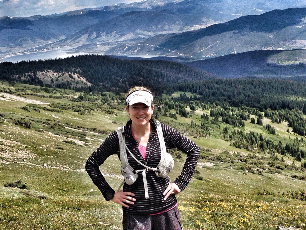
Sunday morning, the group plan was to hike a 14er near Breckenridge. As I am afraid of heights, and the altitude of 9,000 feet at the house had already been affecting me, and the route they were supposed to take had a lot of exposure, I opted out and went for a run instead. I left early in the hopes of avoiding the thunderstorms that were forecast for most of the day.
![IMG_0668[1]](https://jpchronicles.com/wp-content/uploads/2014/08/img_06681.jpg)
My friend Jay, our host for the weekend, led me to the trail system to get started.
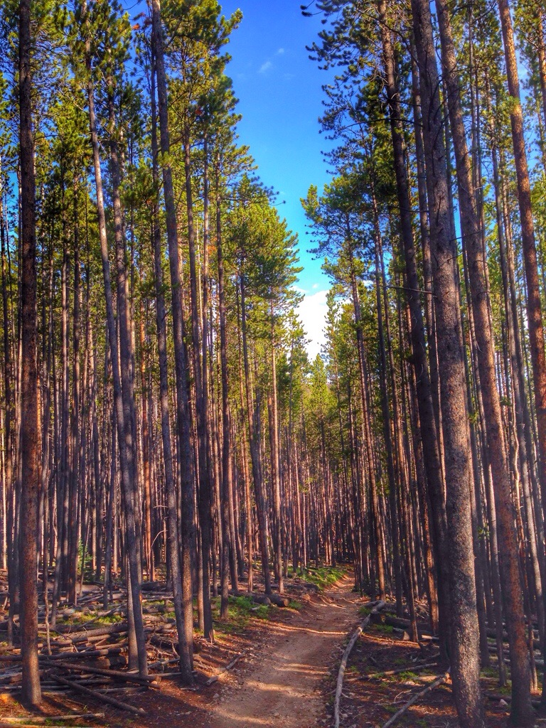
We began at the Breckenridge Nordic Center, and linked over to the Peaks Trail. My original thought was to do an out and back to Frisco, about 20 miles, relatively flat. That sounded pretty boring though, so with Jay’s assistance at the trailhead map, I decided to continue on the Peaks Trail about 6 miles and make a left turn on the Miners Trail. Jay proceeded with his bike ride and left me to my running.
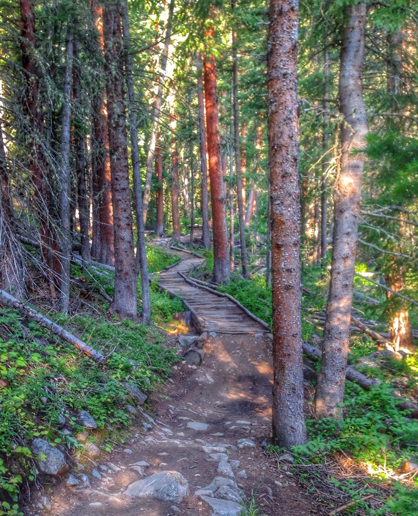
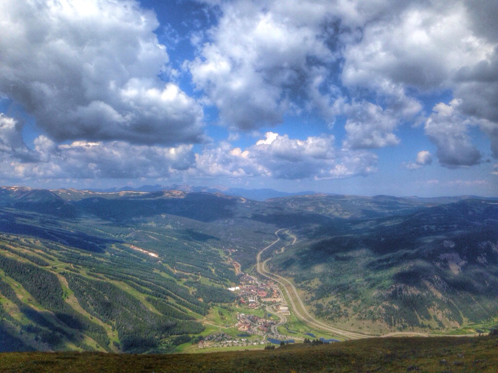
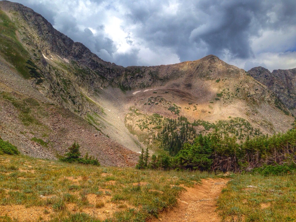
I didn’t know anything about the Miners Trail aside from there would be some serious gain in elevation. Although I live at 6,000′, anything over 8k seems to affect me so I was mildly nervous about doing a long run, all above 9,000′. I came across a clearing about 4 miles in that gave me a nice panorama of the surrounding area. Up until this point and soon afterwards, the trail was surrounded by trees.
![IMG_0664[1]](https://jpchronicles.com/wp-content/uploads/2014/08/img_06641.jpg)

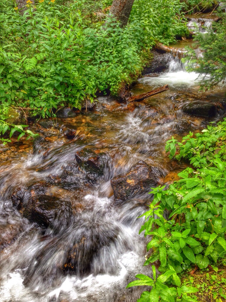
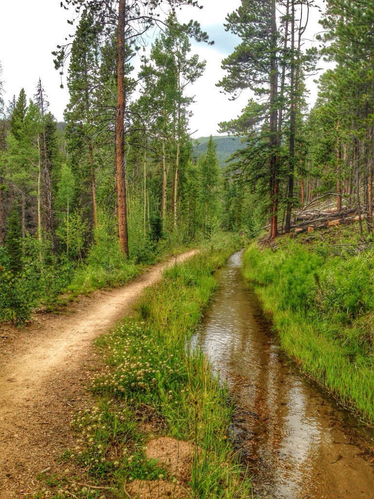
The Peaks Trail and the Miners trail had ample creeks and rushing water. As I climbed up the Miners trail, and got above 10k elevation, I noticed my hands and fingers were swelling up. I took note of it, but didn’t want to worry about it.
Running alone through the quiet woods, I hoped I wouldn’t see any bears or mountain lions. Right after that thought crossed my mind, I looked up and saw something big next to a creek. It was just a hiker but I definitely gasped and almost tripped.
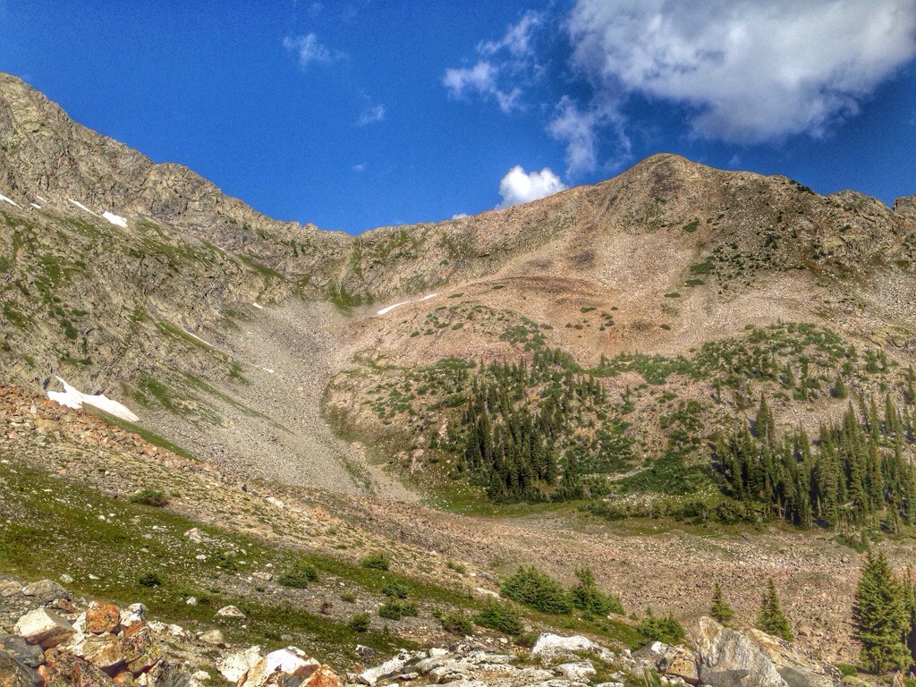
The trail continued climbing up, and I crossed a few gullies that allowed for sweeping views up the mountains, the first views outside the woods of the day. I became hopeful that the trail would take me up to the ridgeline, but I really had no idea where it was headed.
After a fairly steep stretch up along a creek with some small waterfalls, I came across a spectacular granite section and could finally see that my trail was in fact leading up to the ridge.
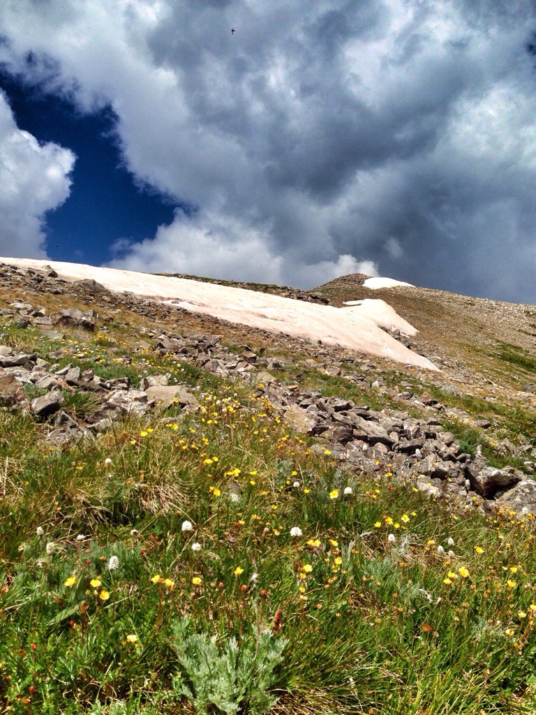
My elevation was now above 11,000′, the highest I’ve ever ran before. The sky had some billowy clouds moving in, and I worried about the timing with which I would reach the high point of the trail, and for how long I might be exposed to the elements. I’m not afraid of rain, but I can’t think of much worse fates than being caught in a lightning storm on an exposed ridge. I continued on.
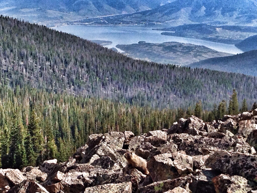
I was relishing in the perfect stillness, climbing up, when a piercing screech shot through the air. I screamed back in surprise, and then discovered it was a little marmot on a rock pile about 20 feet away.
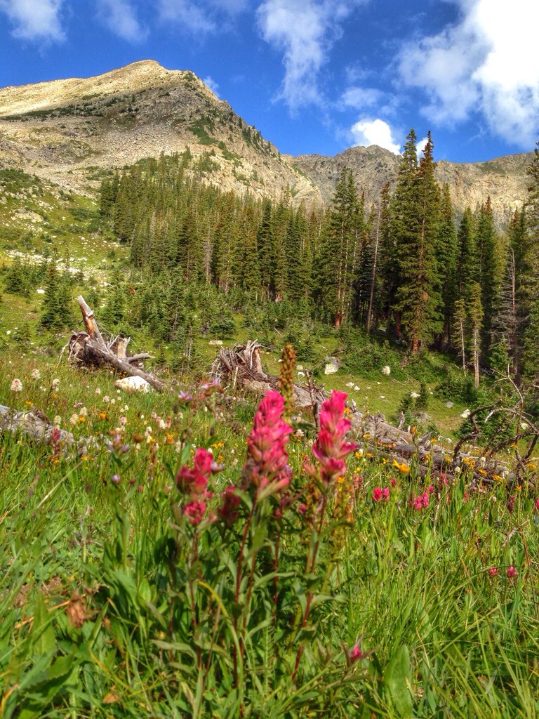
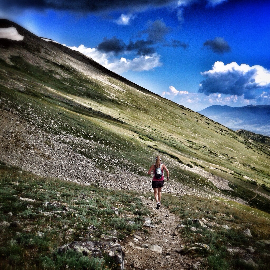
My excitement grew great as I crested the ridge and followed a spectacular single track along the other side. This was the most beautiful place I had ever run. And it was completely unexpected. Sometimes you go somewhere because you have heard about it and know what is coming – today was not the norm. I started off in the woods, and this dream of a trail seemed to unfold before me.

I came across a hiker and we paused to discuss the pending storm. She thought we had about an hour remaining until it would hit.
I was now running at 11,800′, and had a new goal if making it to at least 12k. As I reached the top of the second ridge, my altimeter read 12,000. Success!
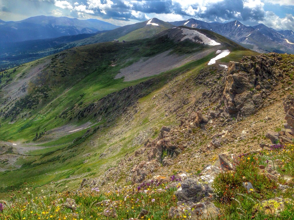
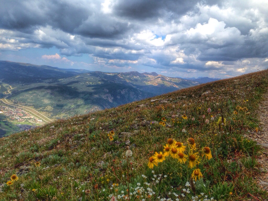
On one side, I could see Breckenridge, and on the other, Copper Mountain.
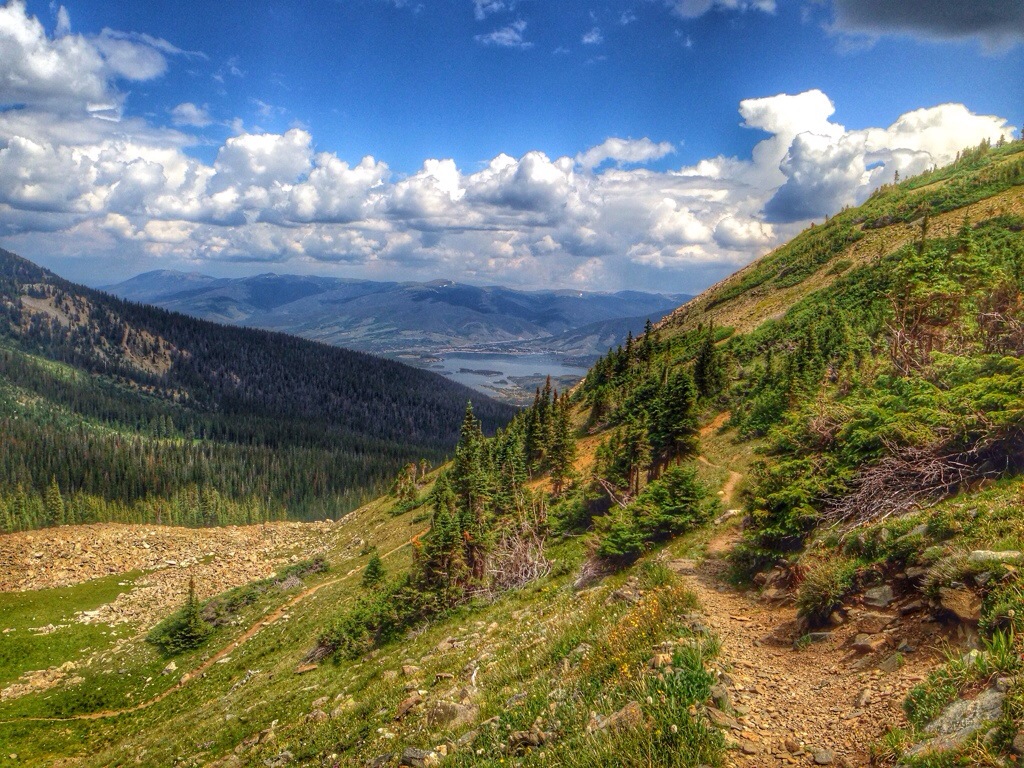
On this second ridge, after discussing my options with another hiker, I started down the other side towards Copper and the Wheeler Trail. However, as I descended nearly 1,000 feet and the storm clouds continued rolling in, I couldn’t commit to taking a different route back with no map and the threat of thunderstorms and even more climbing. I returned back the way I had come, just as it started sprinkling. I was now at 12.5 miles and about 3,800′ total gain.
If I hadn’t seen a couple other hikers out, and discussed the storms with them, I would have been terrified. But knowing that I wasn’t alone up there made all the difference.
Running back down the trail, with intermittent sprinkles of rain, I was happy to be heading back and daydreamed about drinking a beer and soaking in the hottub.
When I returned to the Peaks trail, I came across loads of hikers and mountain bikers. Definitely not alone.
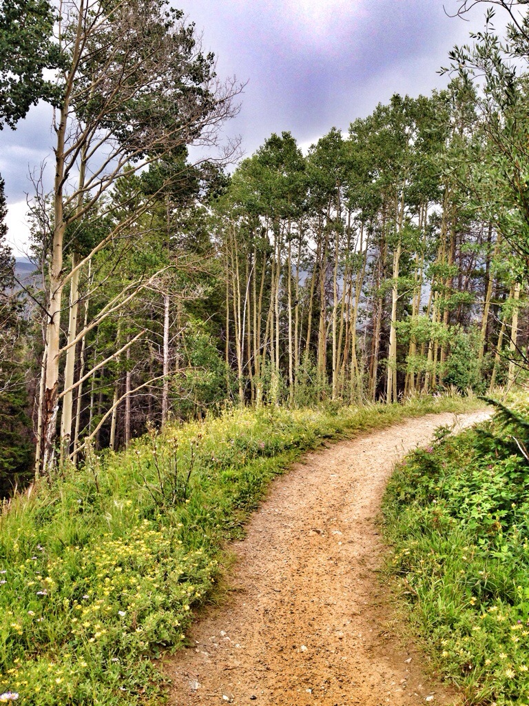
The run back through the woods was peaceful and a bit challenging as I wished I’d brought more food and water. I was rejuvenated after splashing some ice cold creek water in my face along this beautiful section which follows a creek for about a mile.
I came across Jay again, on his second ride of the day, with about two miles to go. I later learned that they came across a gigantic bull moose shortly after seeing me. The rain mostly held off until I got to the house, but I did have the benefit of listening to the thunder in the distance as I made the final push.
Total distance was 25.8 miles and 4,790 feet of climbing. I finished around 2:15pm and had a relaxing last afternoon in Breckenrige. I love Colorado.

How lucky you are to run in Colorado! It is perhaps one of the most beautiful places I have ever visited. Thanks for the wonderful recap with pictures!
LikeLike
Thank you, Ben! I felt very luck to be there! 🙂
LikeLike