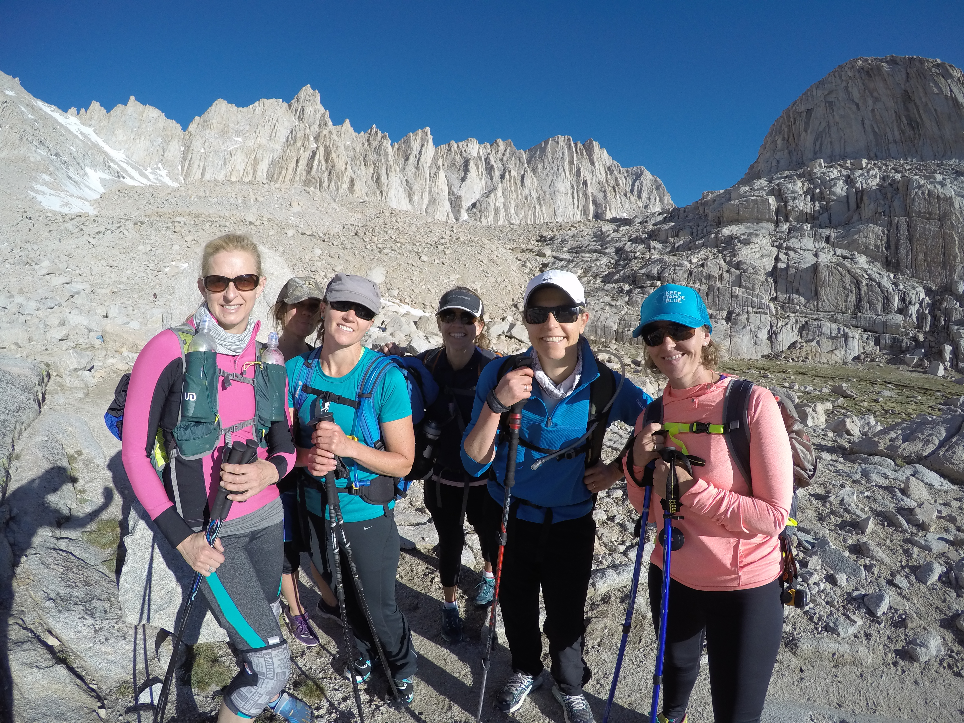
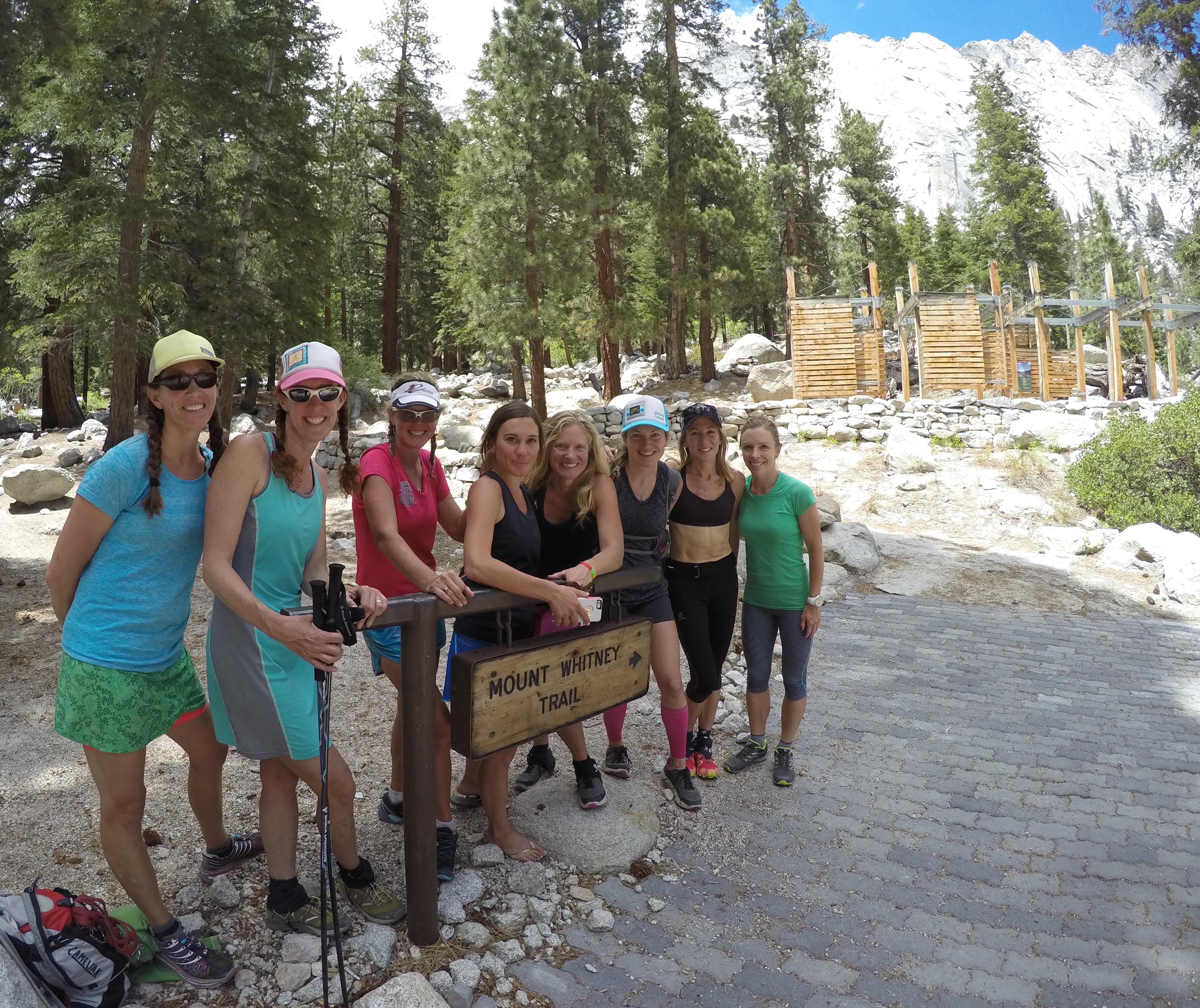
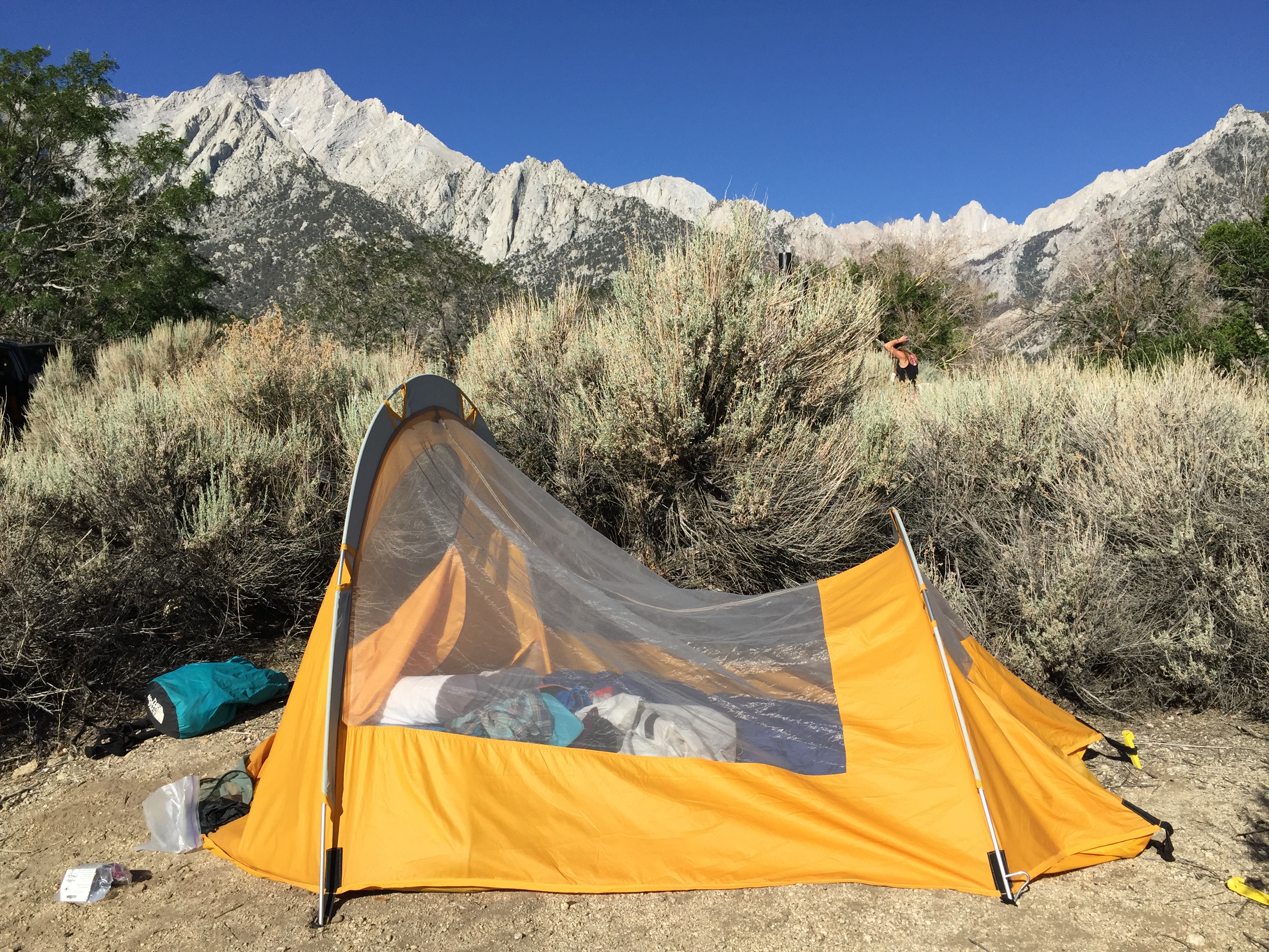
A group of 13 amazing women, 12 from Truckee and 1 from Hong Kong, gathered at the Lone Pine Campground on Friday, June 12, to celebrate our lovely friend Angela’s 40th year of life.

We trickled in throughout the evening, setting up camp, and preparing our gear, for the upcoming adventure on Mt. Whitney.
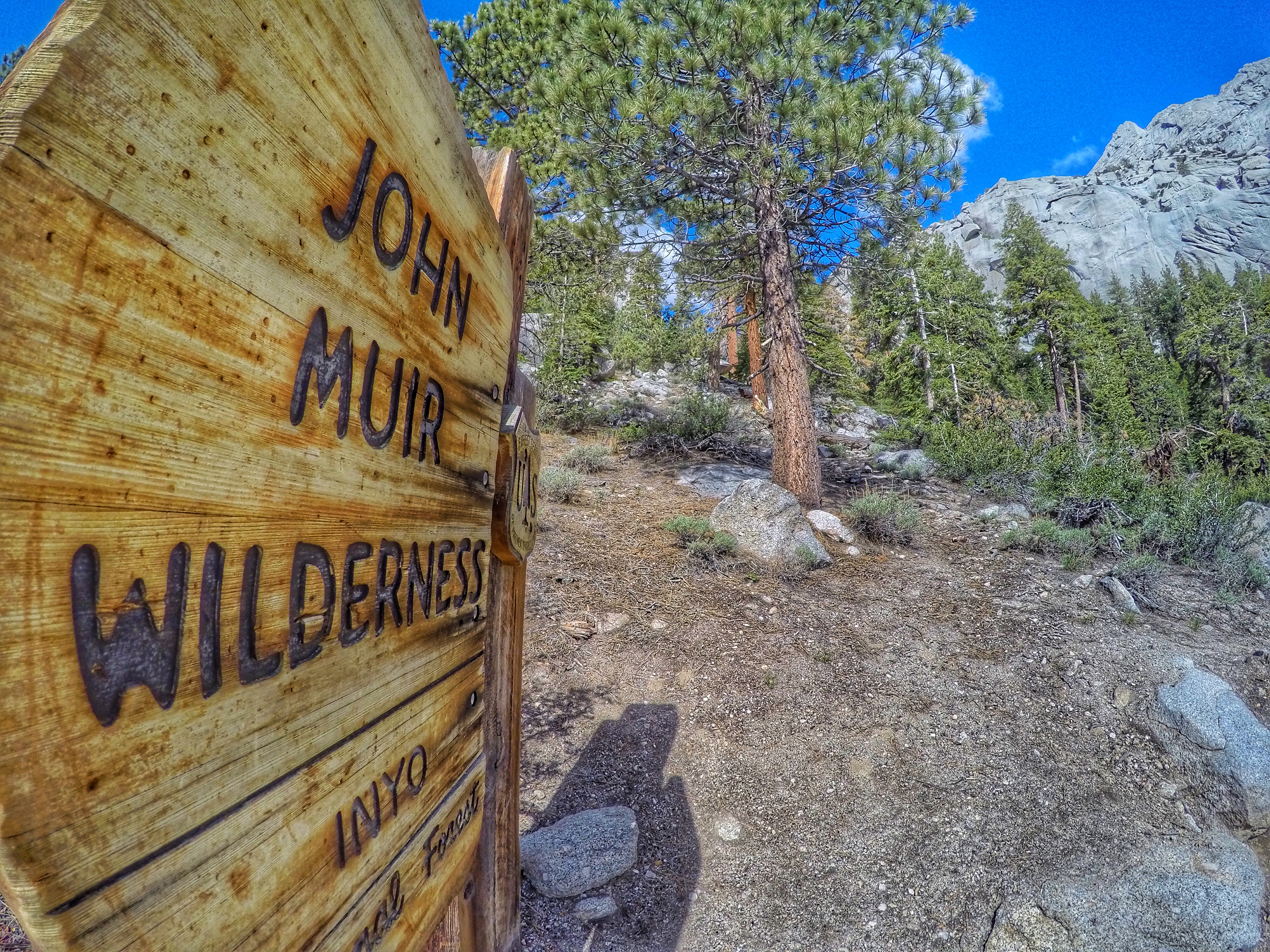
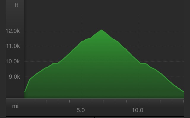
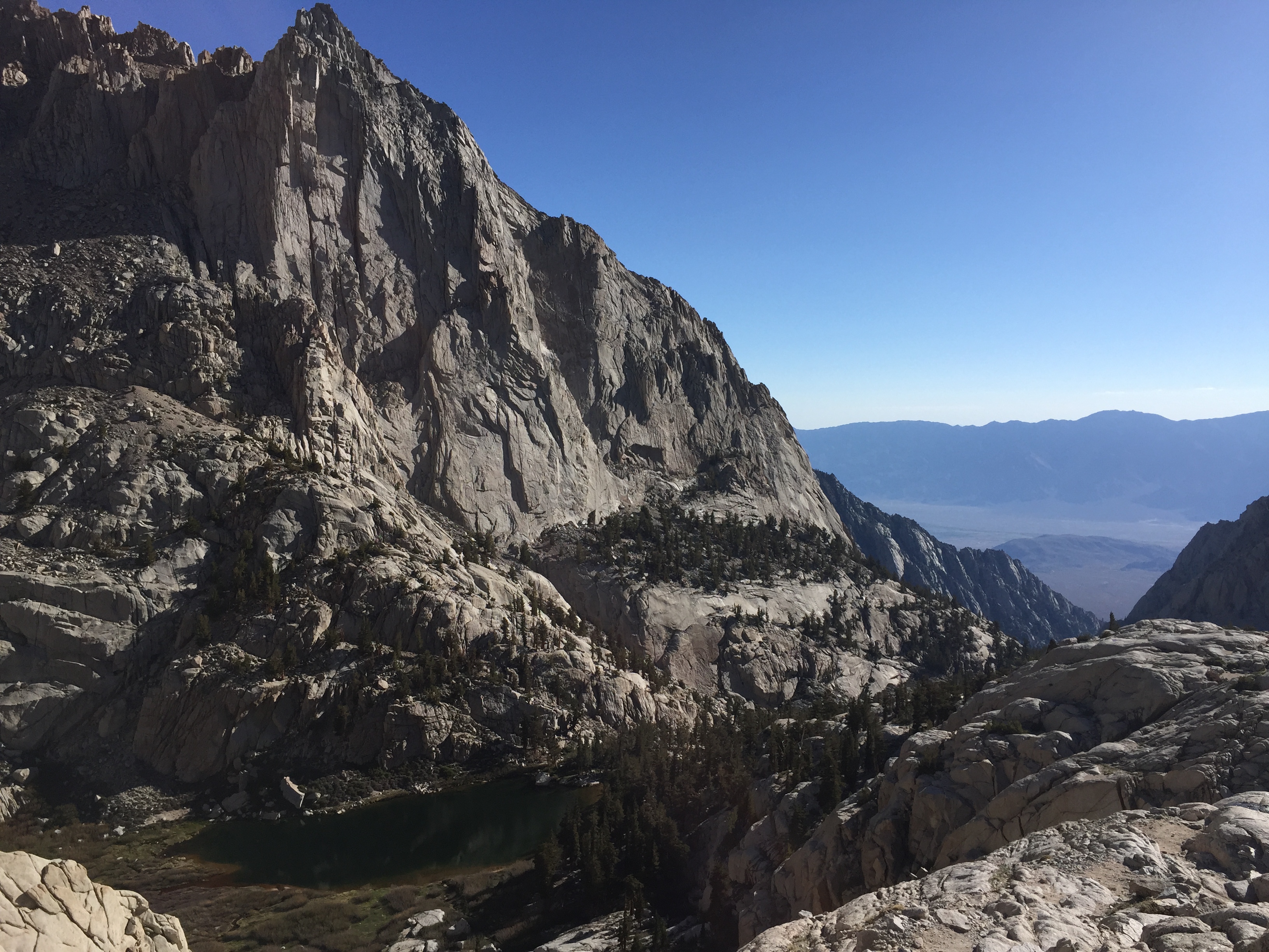
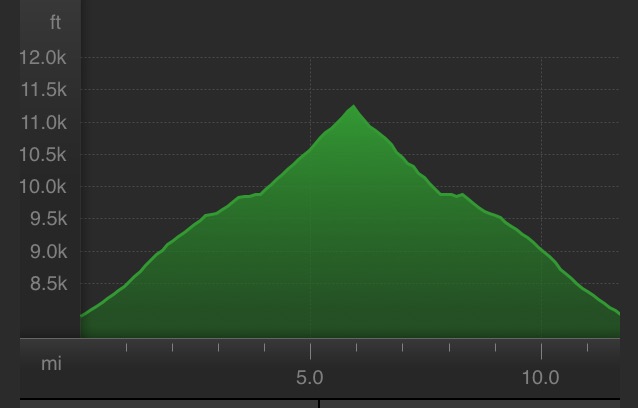
The hike on the Mt. Whitney Trail is about 22 mi out-and-back, with an elevation gain of over 6,100 feet, from a starting elevation of 8,360′ at the Whitney Portal, up to a high point of 14,505′ (the highest point in the lower 48). As the other girls packed their crampons, I let them know I would turn back if there was any snow/ice that required such traction devices, due to my extreme fear of falling. A few of them didn’t believe me, but I was serious.
At 2am, our alarms started going off, and we woke up (those of us who were able to sleep for the 3 hours, that is), to a quick breakfast and coffee before driving up to the Mt. Whitney Trailhead, about 15 minutes up the Whitney Portal Road.
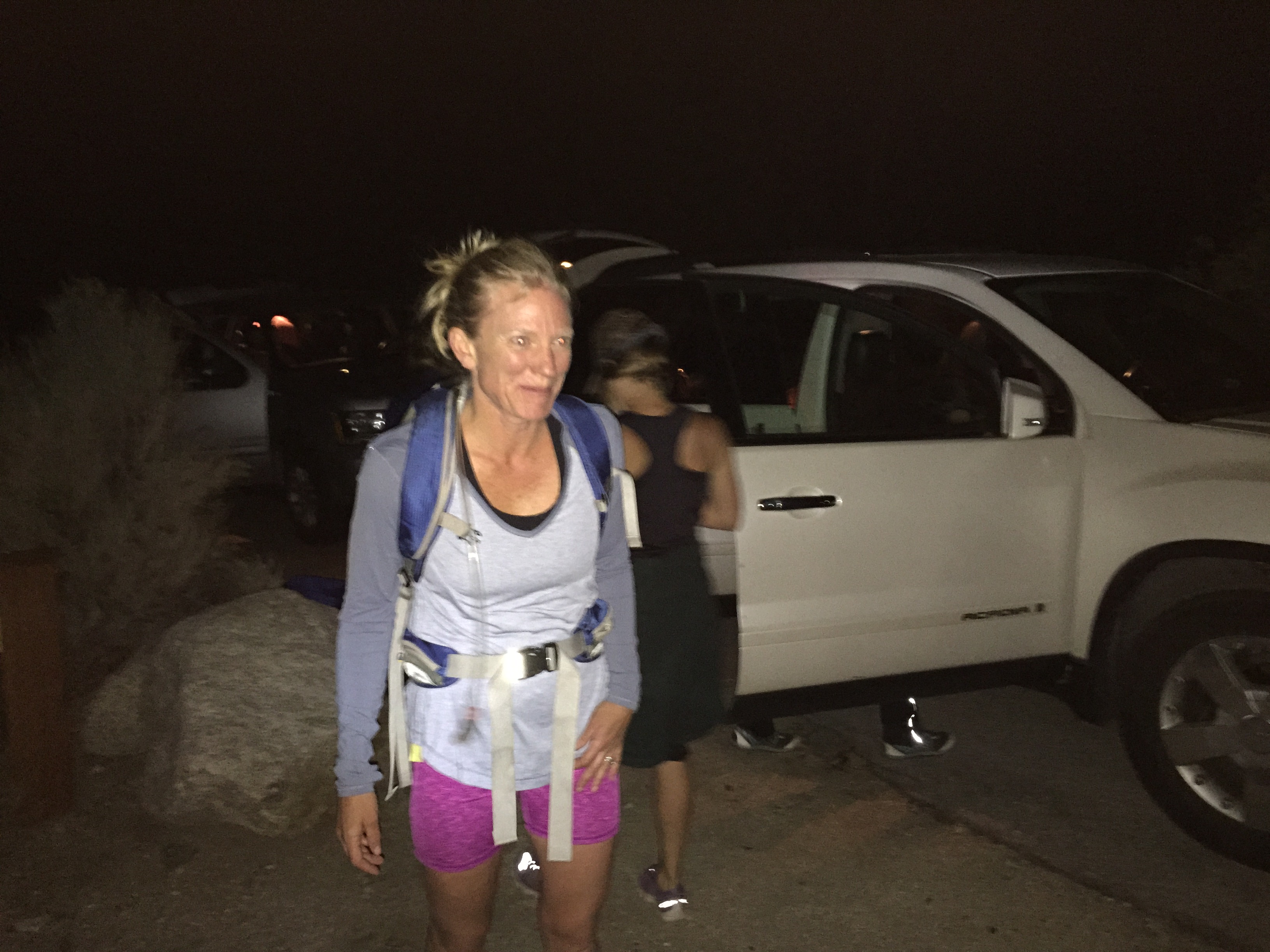
We set off on the trail at 3:28am, our only real plans discussed were to sign out in a log book at the end of the trail when we finished, so that everyone was accounted for.
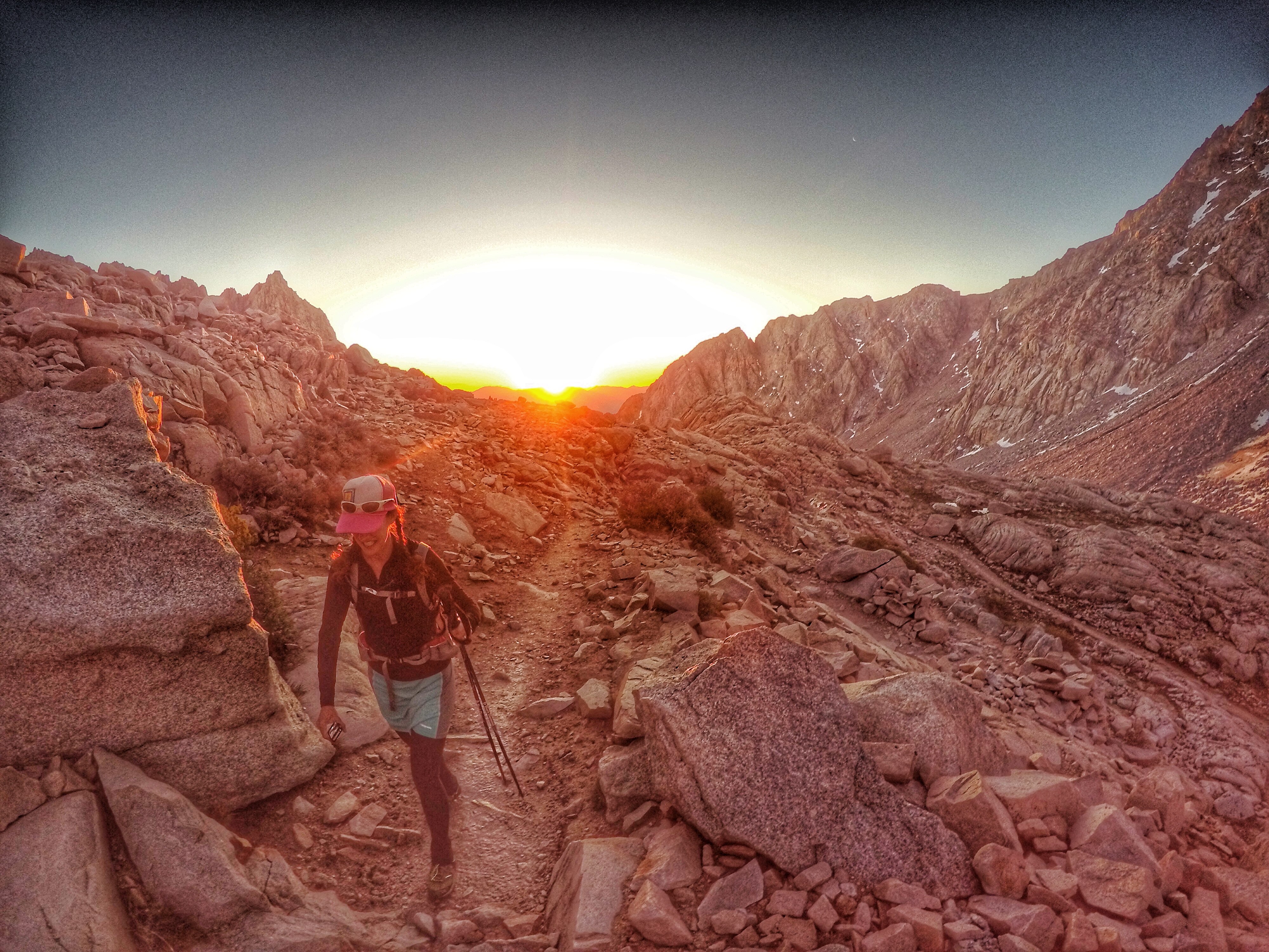
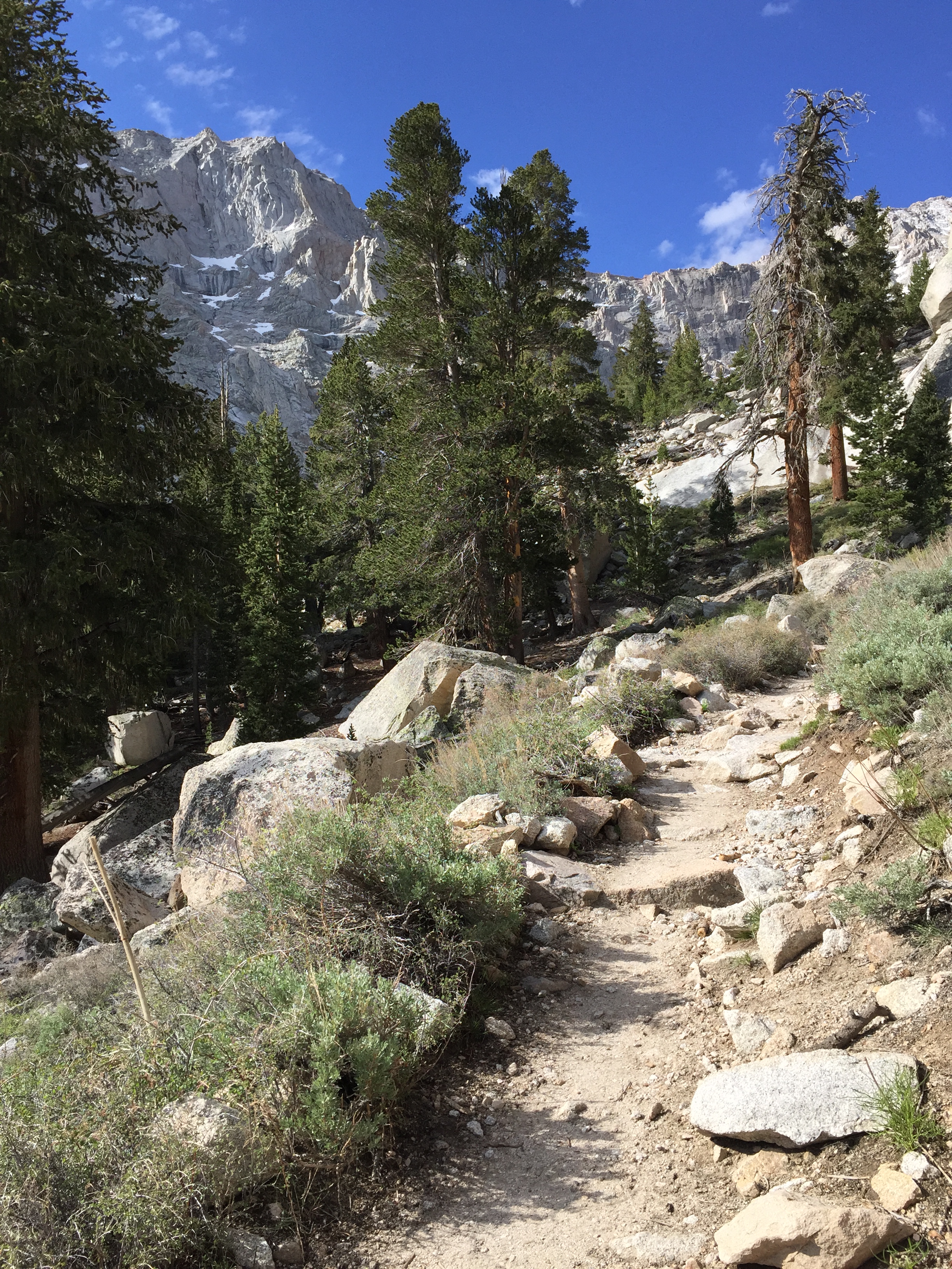
A couple different groups naturally formed, and we head out into the darkness. I ended up with Betsy, Angela, Janel, Claire, Audrey, and Gretchen. The first light of day brought a spectacular glow to the surreal landscape.

We gathered at the Trail Camp, 6 miles in, at 12,000′ elevation, and Gretchen, Claire, Audrey, Betsy and Janel took off easily up the switchbacks. Angela and I followed slightly slower, both of us feeling the effects of the altitude. We realized we had hardly drank any of our Tailwind, even though we had been out there for 3 hours… time to drink up, and eat some snacks.
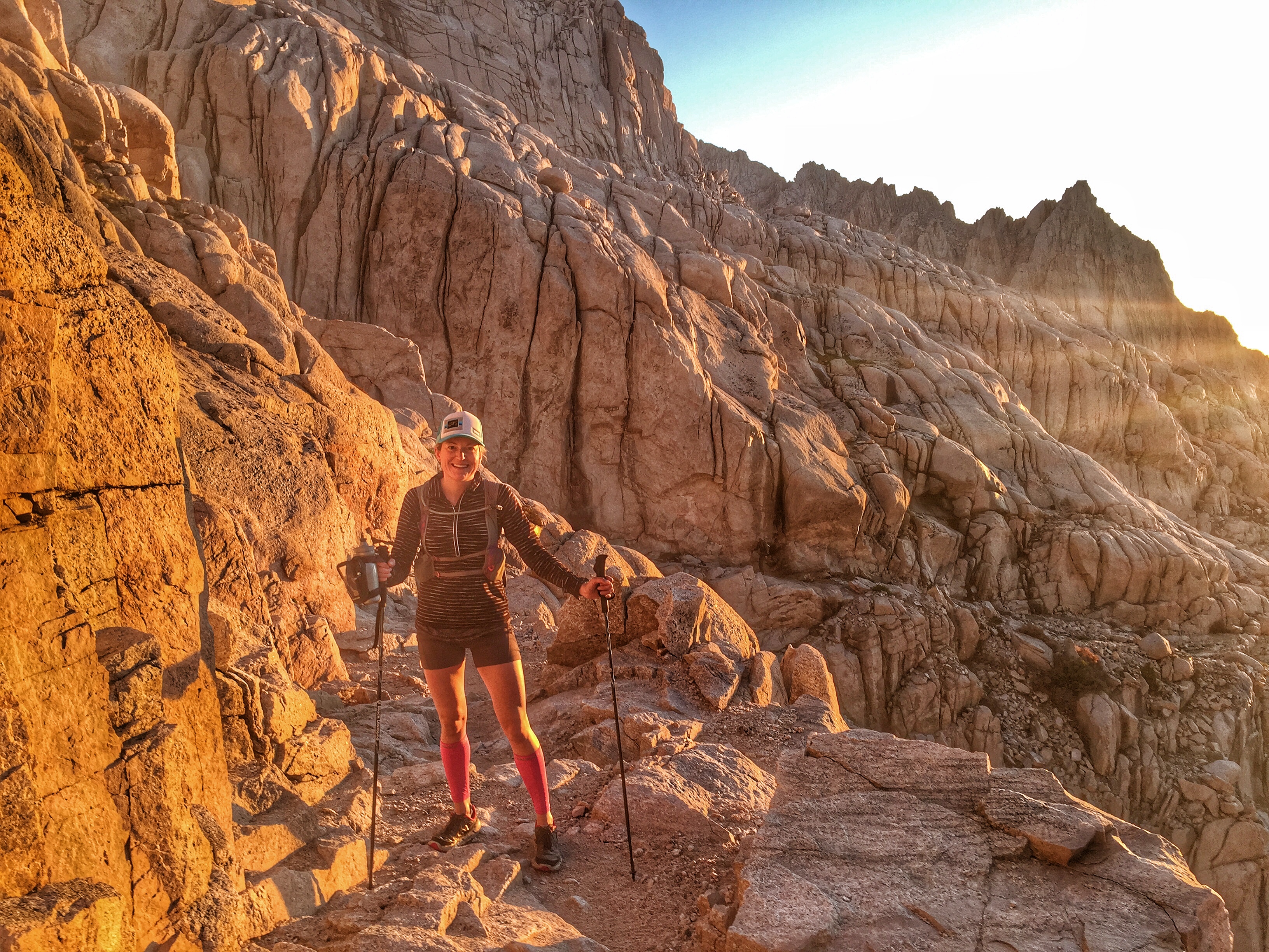
Just as we were both feeling better, and I was starting to think that maybe I could actually reach the summit, we reached a section called The Cables, which was about 12,500′, a narrow, snow and ice covered set of steps (50 feet long), with a cable railing on the right, to help shield hikers from a steep drop-off.
I immediately knew this would be the point I turned back, and I wished her well (and hoped the others would wait for her! -they did). We snapped a few pics, and she bounded up the trail, and I started my run down, totally ok with my decision. There would be other, dryer times of year to attempt this for myself.


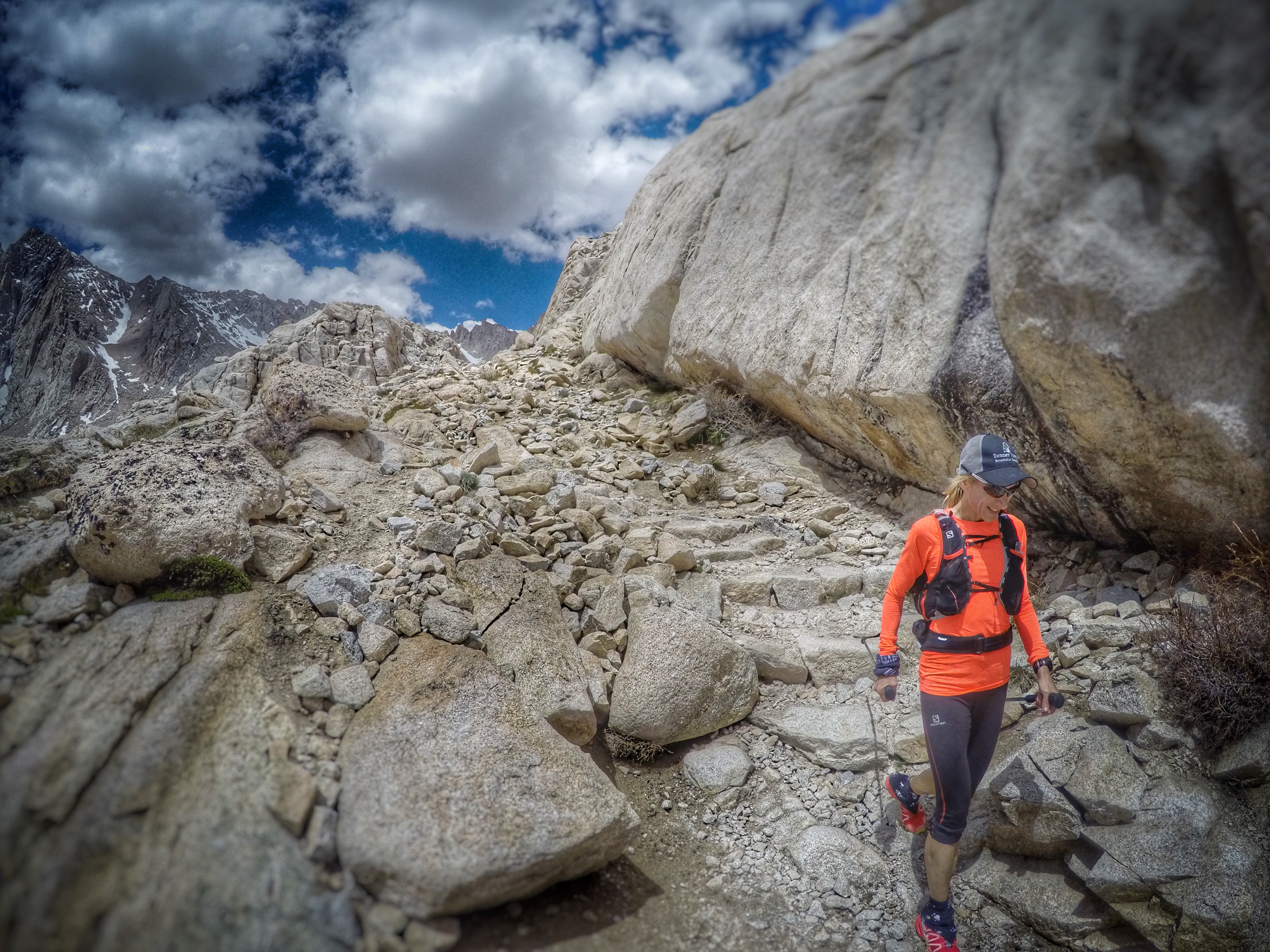
When I reached the Trail Camp again, I came across the rest of our party- looking fresh and excited for their adventure. Including Kelly, in her Vibram Five Fingers – I’m not joking.

I told them how scary I thought The Cable section was, and a couple of them implied that they might turn back as well. I told them I was going to run down to the car and then come back up to meet the first ones down. At that moment, I felt confident that I could do this. 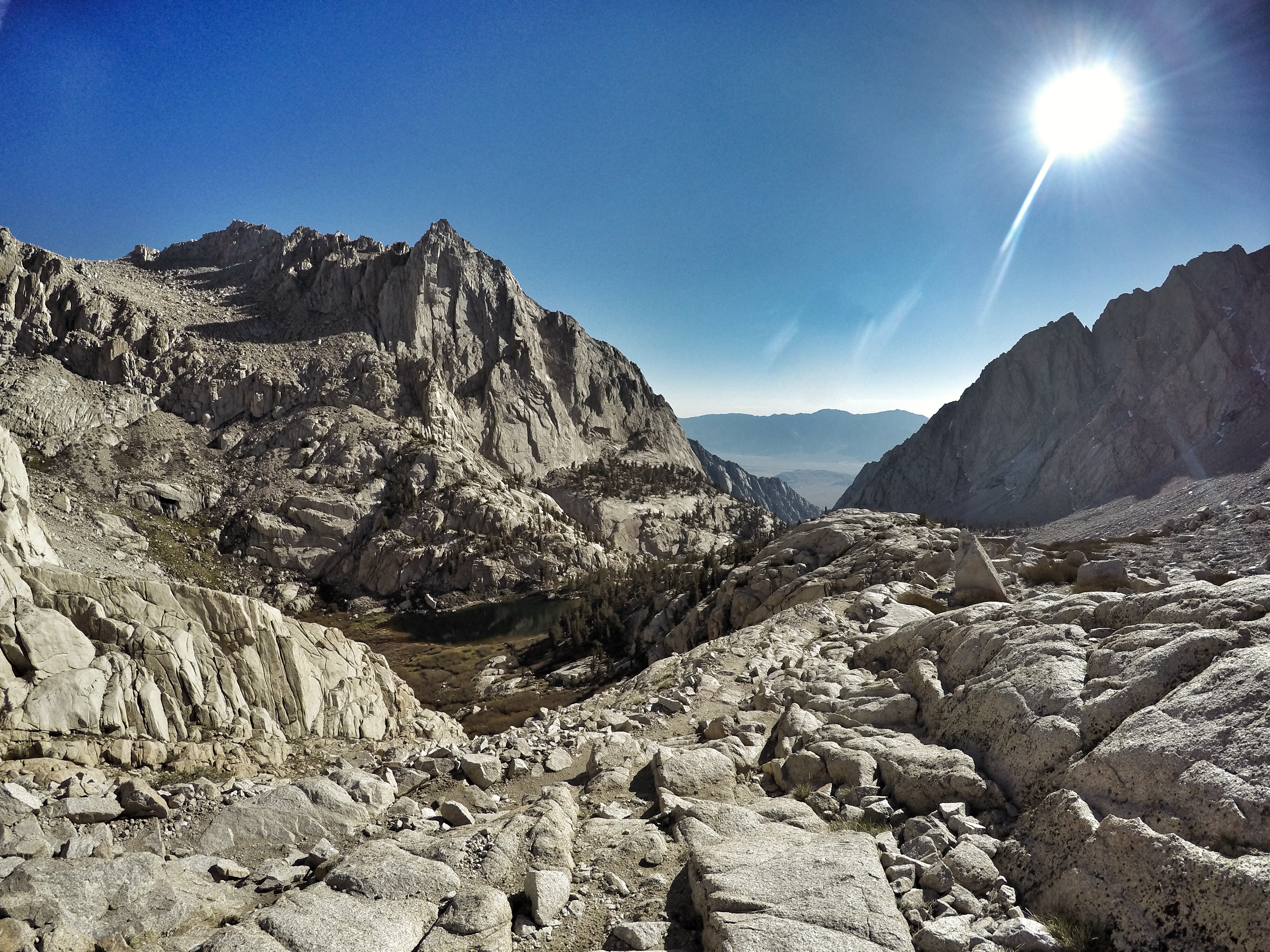 I had an awesome time cruising down, with the exception of each time someone asked me, “you already summitted?!” and I had to admit that no, I had chickened out.
  The way up, although it was dark, seemed to go by so much quicker, probably because I was so anxious about coming to a point that I would be afraid to continue. This time down, as the day got warmer and the trail seemed to grow longer, I started to doubt that I would have it in me to come back up again once I reached the car. I just drank more Tailwind and had some snacks to restore my energy- salmon jerky and a granola bar.
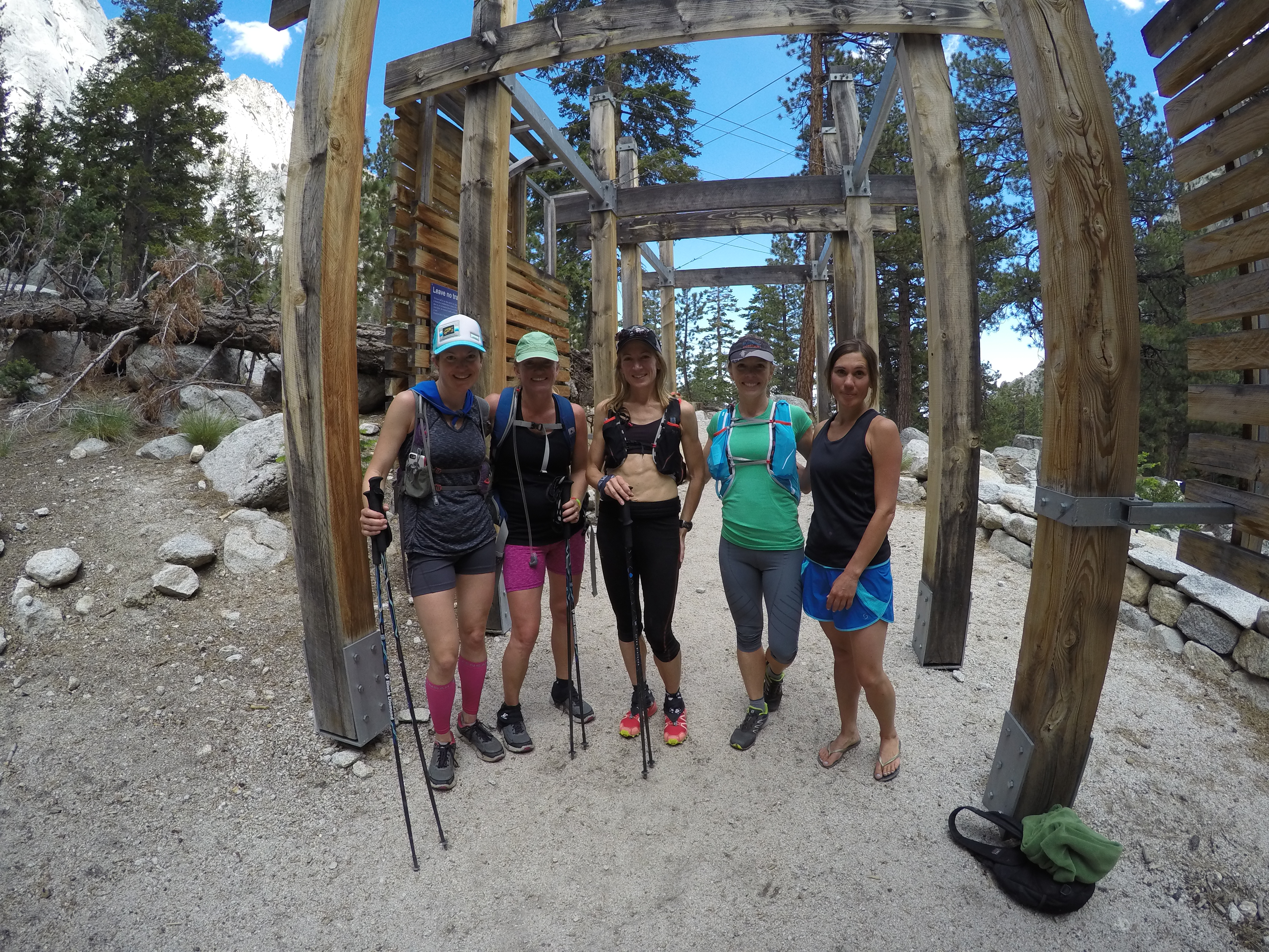
I reached the bottom of the trail around 9:30am- total time out so far over 5 1/2 hours.
I dropped off some layers (it was already up to about 85 degrees), refilled my bladder with some nice cold water, and headed back up. I was pleased to find that it felt like I was just beginning the day – I jogged most of the way up, only walking where it was more efficient than running.
I saw many people that I had passed on the way down, and each time, they looked up in surprise, and expressed their shock that I was going up again. This made me run faster. 🙂
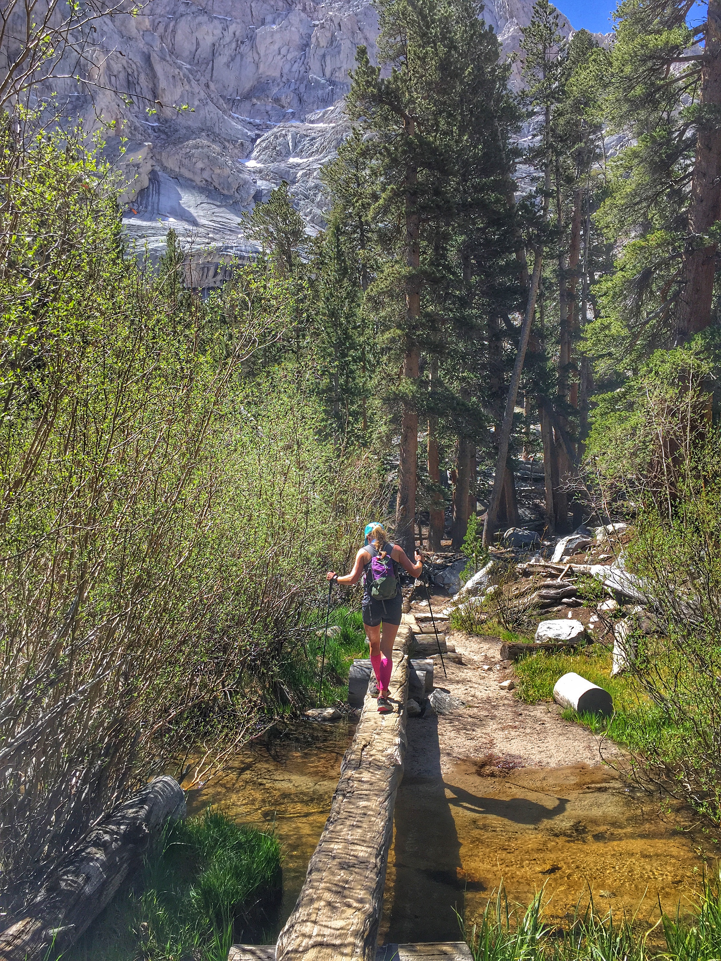
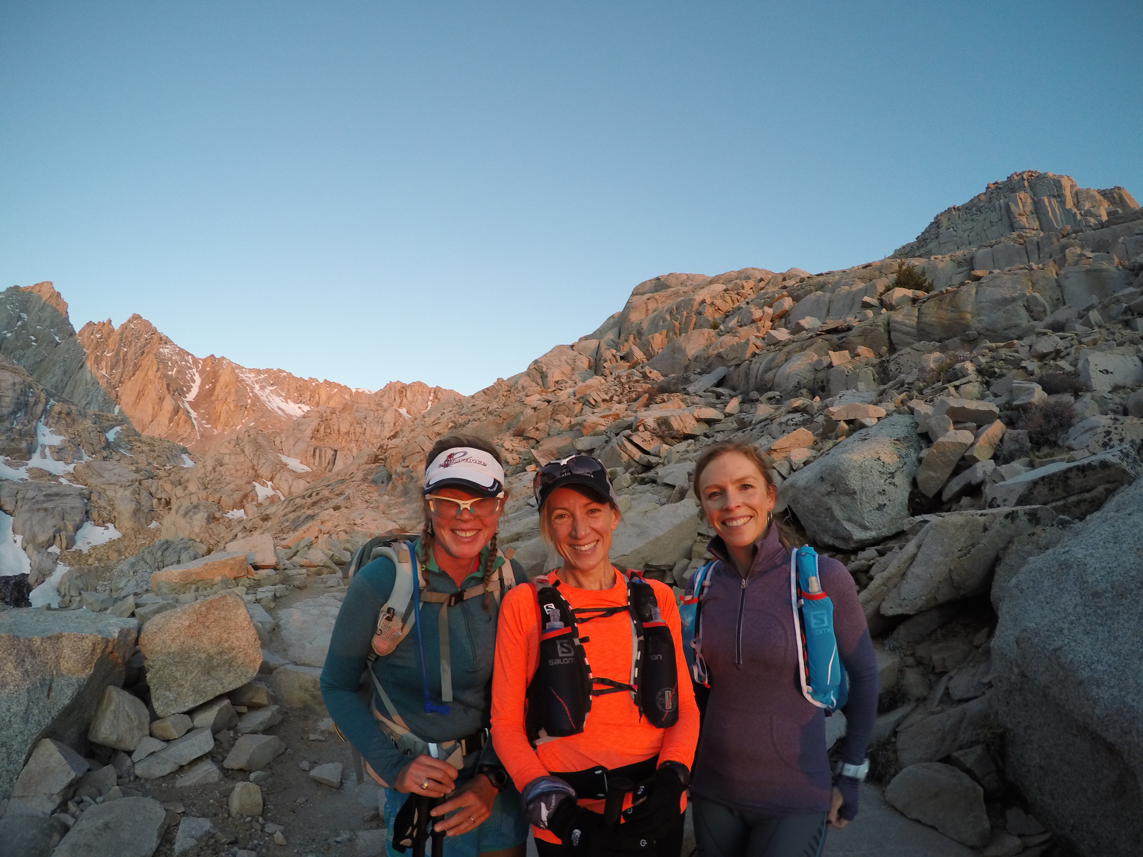
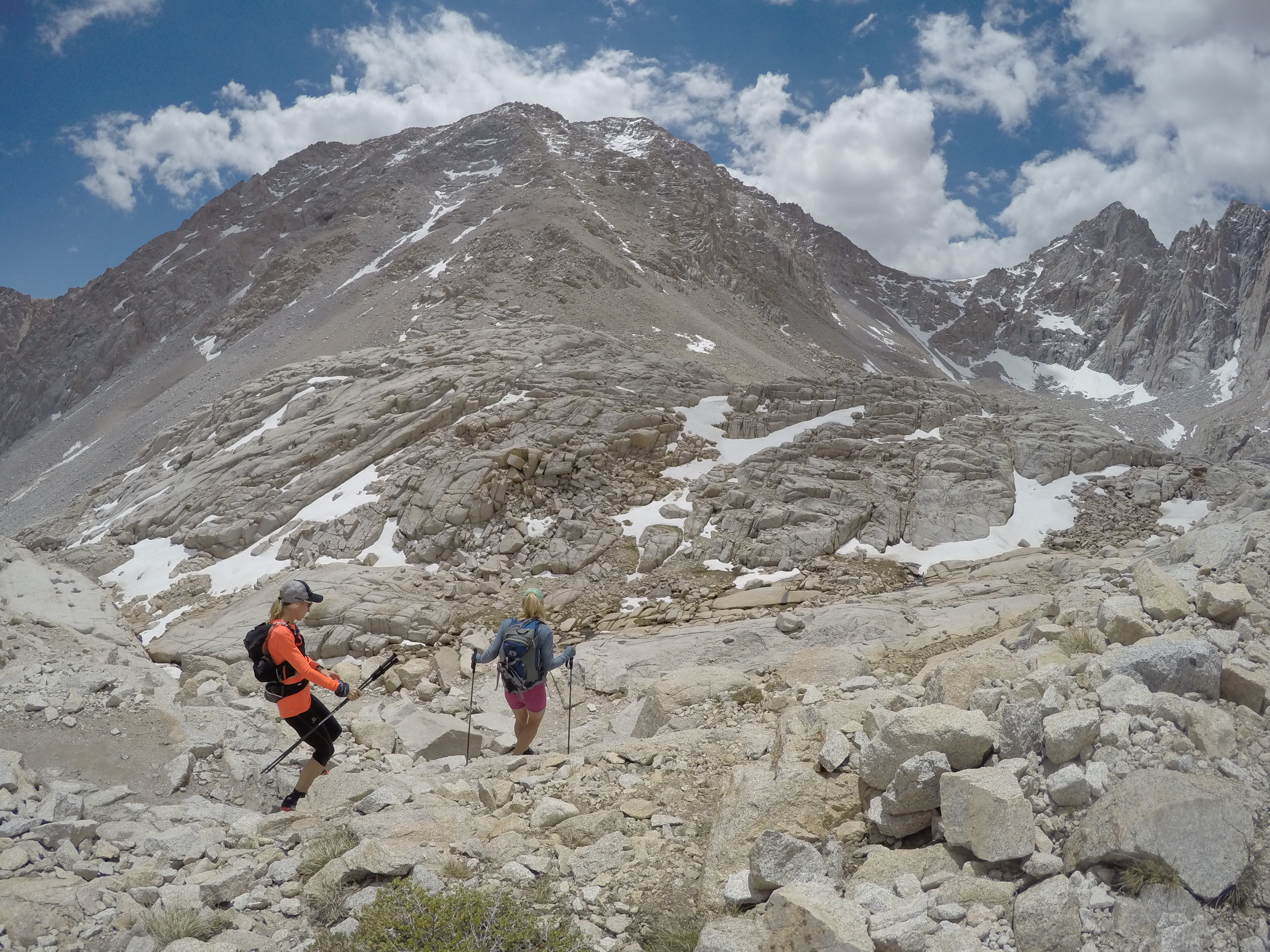
 I met up with my friends again about 5.5 miles up. They had all made it to the summit, and were super stoked. We had a wonderful time running down, stopping often for photos, or to check out the scenery they had missed, coming up in the dark.
We also stopped to refill our water, using our incredible little Mini Sawyer devices I picked up at Alpenglow Sports on the way out of town. Easiest, lightest, and cheapest water filter I’ve seen yet!

We reached the trailhead 3 hours, 55 minutes after I went back up again, around 1pm. We had been out there around 11 hours. The girls were all super stoked to have summitted Mt. Whitney (several of them for their first time), and I was stoked to have gotten a long, quality training run in- nearly 27 miles, with over 7,700 feet of climbing.
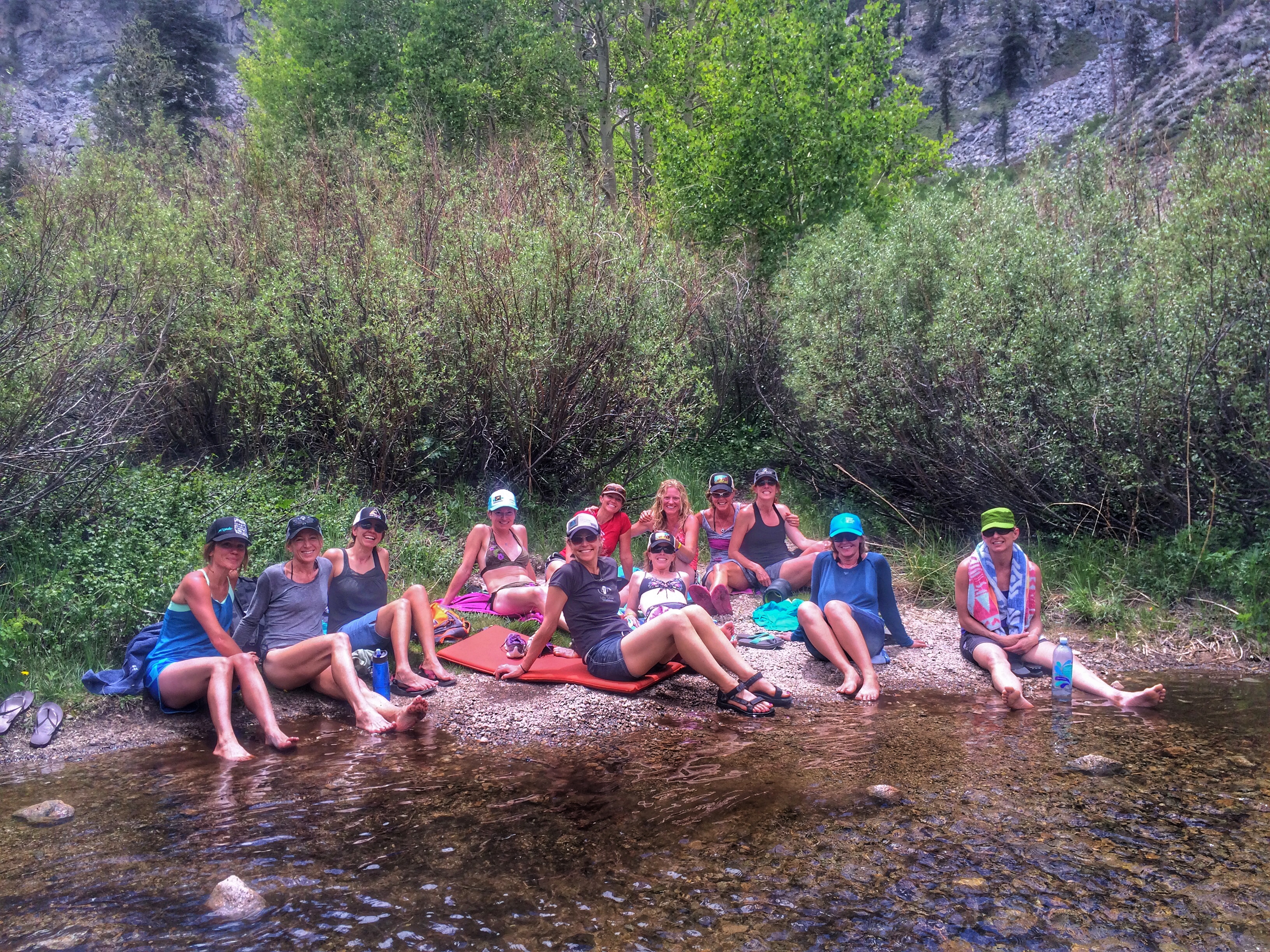
We headed back to the campground, cooled off in the creek (it was over 90 degrees at our site), and hung out waiting for the 2nd group.
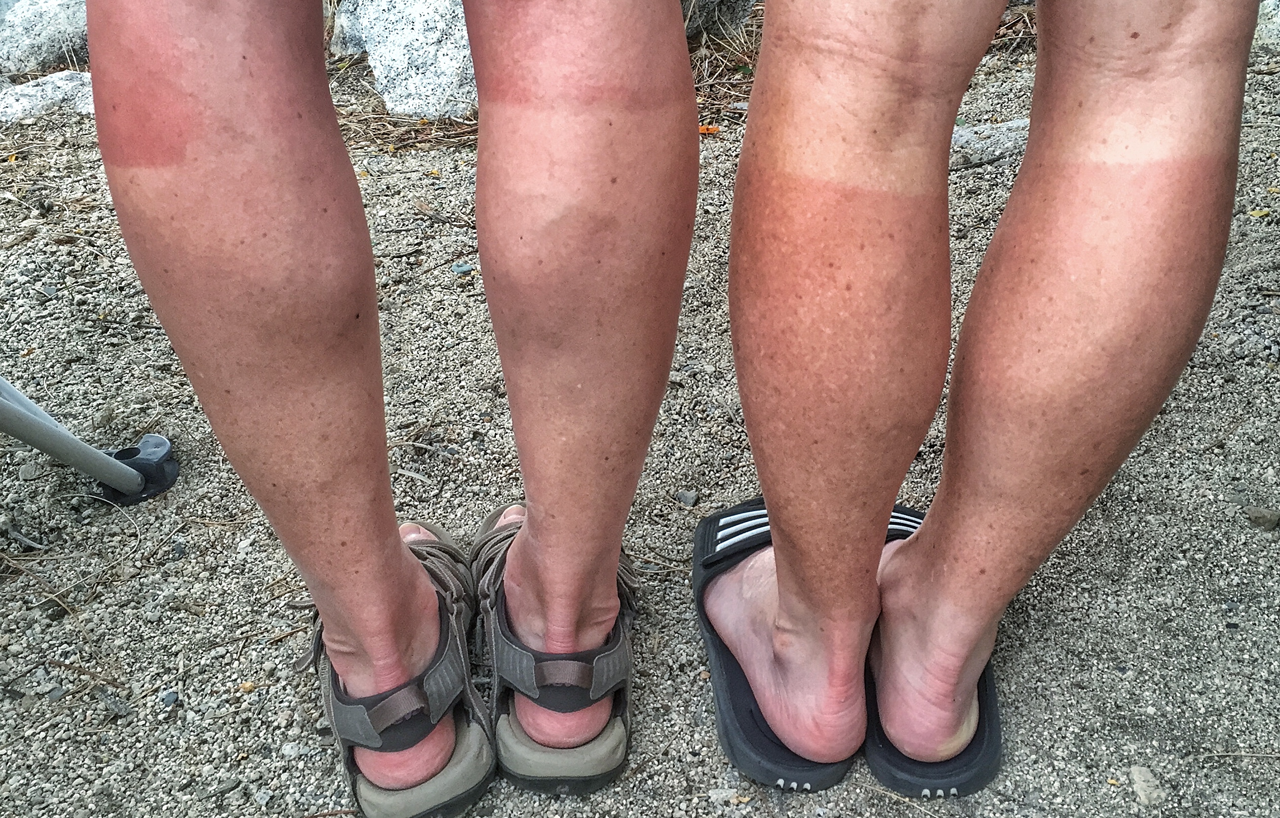
Audrey and I compared our stylish new tan lines- hers from capris, and mine from calf sleeves:
We watched the afternoon storms come in, and began to worry about our girlfriends still on the Mountain… but alas, these were some very badass, tough women, and all 5 of the 2nd group reached the summit, and made it back down to their car safely despite the thunder, hail, and rain that pummeled them.
That night we had a birthday party for Angela – tostadas for dinner, lots of alcohol, special cakes from a bakery in Bishop, and an early bedtime (thank goodness).


The next morning, we awoke early, shared a big breakfast and a lot of coffee, and packed up the camp.
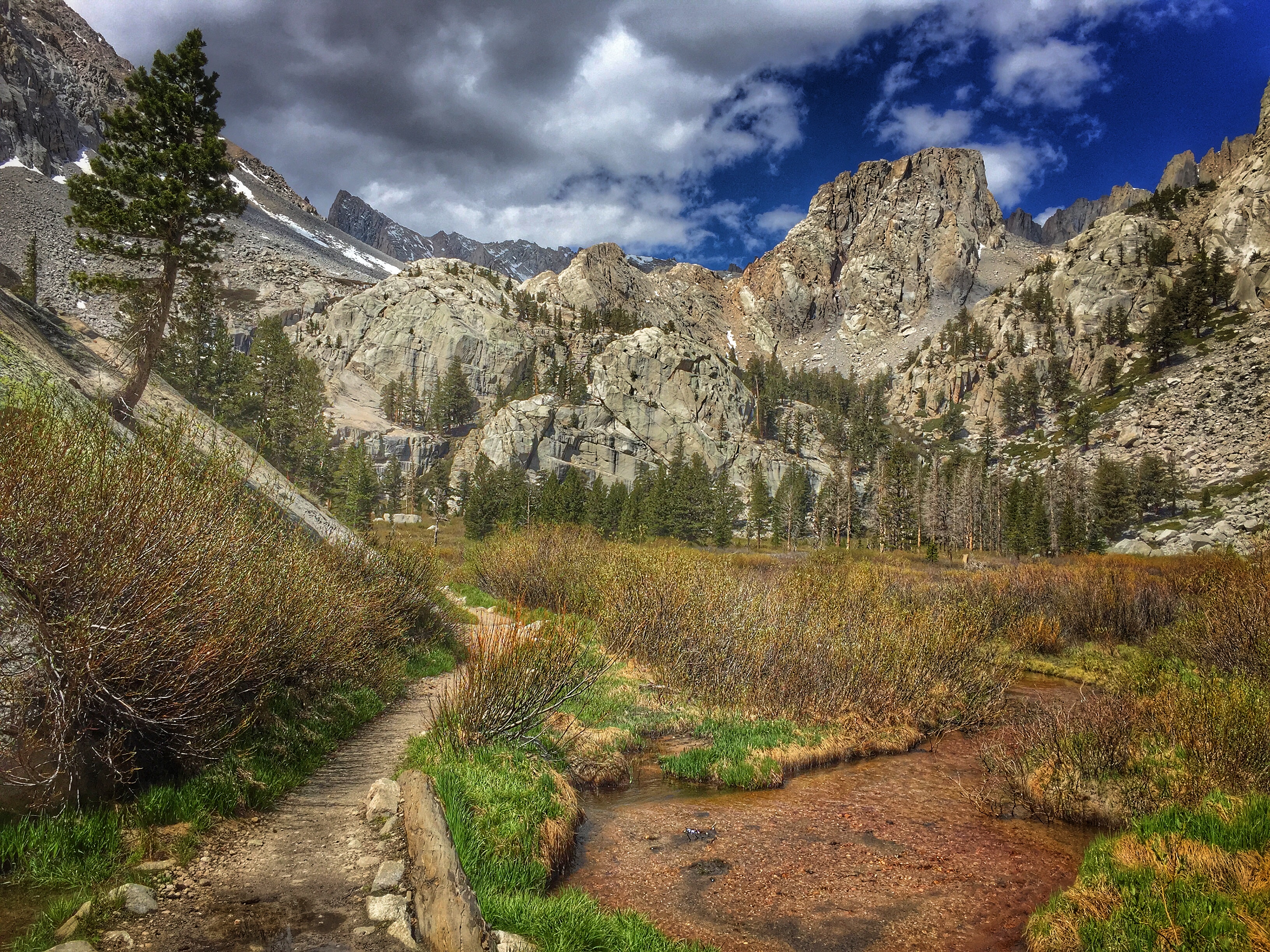
We drove to Onion Valley (elevation 9,200′) to run up/down Kearsarge Pass (elevation 11,700). It was beyond gorgeous – we were blown away. The trail was very runnable, the only thing that slowed us down was the high altitude, but that didn’t even bother us too much this 2nd day out.


This run ended up being 9.5 miles round-trip, with about 2,500′ of climbing. At the finish, we cooled off in a creek and enjoyed the scenery.
We stopped in Bishop for shopping on the way home (Eastside Sports– incredible and Sage to Summit, and then at the Mobile Mart in Lee Vining for a final dinner together.
It was the best girls weekend imaginable.


Gretchen dropped me off around 9pm and it was back to reality- including dealing with the mess left behind by the bear on Friday morning… that’s another story altogether.

What a awesome blog Janelle! So lucky I was able to celebrate Angela’s birthday with amazing ladies! Gorgeous place to celebrate!
LikeLike
Thanks, Brittany! It was such an awesome weekend. Can’t wait to get together with all of you again!
LikeLike
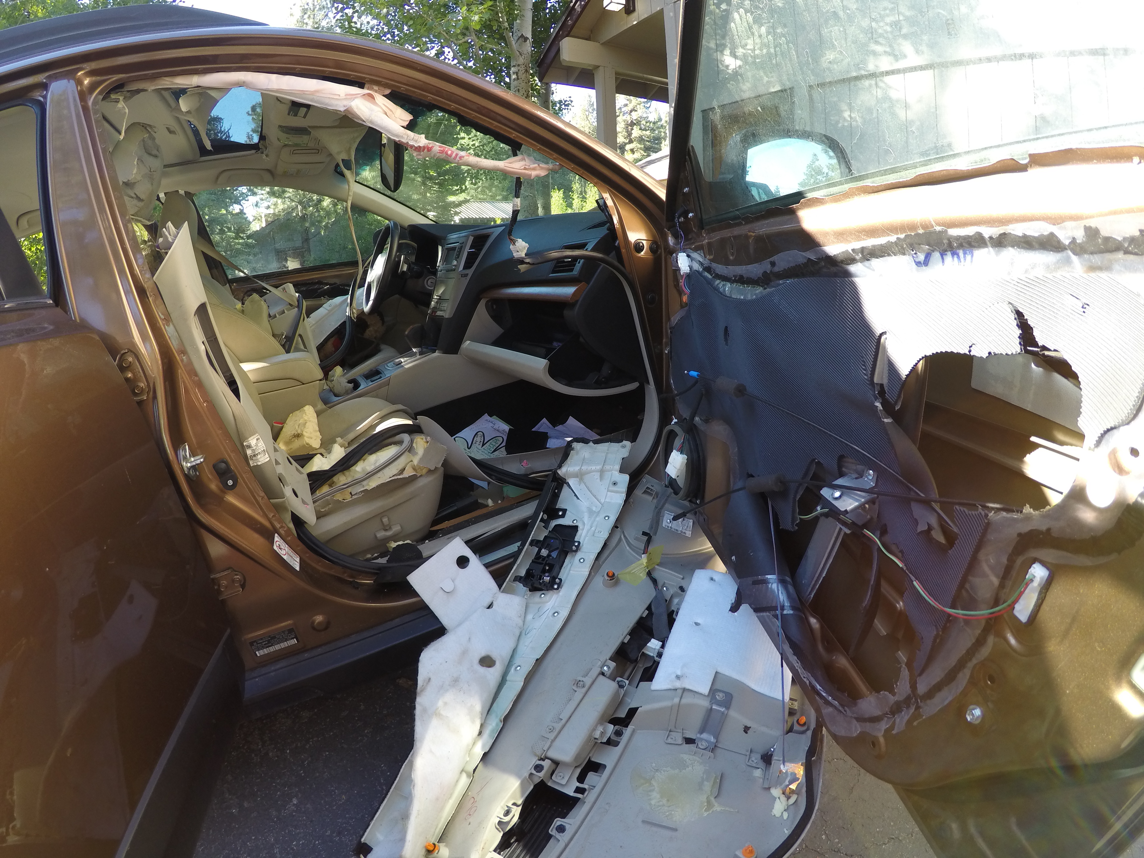
Beautiful Photos. What a birthday celebration . The Bears , your Car , OMG!
LikeLike
Wow ! I’m so jealous ! Maybe you and I could go to the top of Whitney, I’ve only been up once, long before cables were installed, (or permits needed) also not reaching the top because of snow/ice. How do you get permits?
LikeLike
Hi Kathy!! I would absolutely love to go back with you some time! we got permits from recreation.gov they have a lottery at the beginning of the season, but then they open up spots as people don’t claim them.
LikeLike