The Truckee area has a variety of town-maintained trails for winter running. Plowed trails in Truckee include the Truckee River Legacy Trail (5 miles one-way), the Trout Creek Trail (1.5 miles one-way), the Brockway Road Trail (1 mile one-way), and Martis Dam Road (1.5 miles one-way). In nearby Squaw Valley, we have 2.3 miles of paved trails.
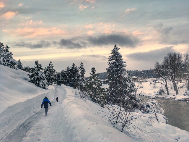
Truckee River Legacy Trail
The longest stretch of plowed trail is the popular Truckee River Legacy Trail, which connects Truckee Regional Park with Glenshire, five miles one-way. Free parking is available in the following locations:
1. near the Ice Skating Rink (10100 Brockway Road Truckee),
2. near the pedestrian bridge at the end of East River Street, downtown Truckee, and
3. in Glenshire, just before the Glenshire neighborhood on Glenshire Drive, approximately 4 miles east of Donner Pass Road.

Trout Creek Trail
The Trout Creek Trail connects Northwoods Boulevard near Coyote Moon Golf Course to Downtown Truckee at Bridge Street just north of Highway 80. This beautiful stretch of trail is approximately 1.5 miles one way, and also provides access to the trails leading to the Pioneer Center (not currently plowed all the way to Pioneer Center, but there is a foot path). Free parking is available at the trailhead on the East side of Northwoods Boulevard, just north of Coyote Moon Golf Course. There is limited paid-parking at the Trout Creek Pocket Park on the north end of Bridge Street in downtown Truckee.
Make it longer: From the Pocket Park on Bridge Street, you can continue south on Bridge Street, cross the railroad tracks, turn left on East River Street, and cross the pedestrian bridge to access the Truckee Legacy Trail (it is about 1.2 miles from trailhead to trailhead). If you start at the parking area in Tahoe Donner and run out and back to Glenshire (or vice versa), you can get about 15 miles in.

Brockway Road Trail
This shorter section (approx 1 mile) of plowed trail links Truckee Regional Park with The Rock (11253 Brockway Road). To make a 2.5 mile loop, start in the Truckee Regional Park, head south on the Brockway Road Trail, turn left on Reynold Way (a residential street, so use caution here), turn left on Martis Drive, then turn right on Ranch Way to access the Legacy Trail under the 267 bypass. Turn left on the Legacy Trail to make your way back to Truckee Regional Park and complete the loop.
Martis Dam Road
Martis Dam Road (located in Martis Valley, less than 1 mile south of Schaffer Mill Road on Hwy 267) is closed to cars in the winter, and is currently plowed 1.5 miles one-way (they sometimes plow 2.25 miles one-way). This full-sun road has sweeping views of the Martis Valley, with Northstar to the south and the Sierra Crest to the west. Free parking is available on Martis Dam Road off of Hwy 267 before the gate.


Squaw Valley Bike Path
The bike path in Squaw Valley, with 2.3 miles of plowed trails, can be accessed from a couple locations during the winter:
- Free parking is available at the east end of the parking lot at Squaw Valley Ski Resort. Note- the first ¼ mile from the resort to the start of the bike path is along the heavily-used Squaw Valley Road, so exercise caution here.
- From the parking lot at the Resort at Squaw Creek, 400 Squaw Creek Road, Olympic Valley.


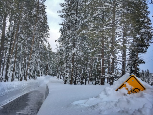
Trails are plowed once after each storm, but some remain snow-covered and icy in places, so use caution. Have other plowed options for running to share? Please comment below!


Thank you Jenelle!
LikeLike
🙂
LikeLike
Thanks Nelly! Let’s run soon!!
LikeLike
tomorrow morning? 5:30?
LikeLike
Thanks TRUCKEE!!!
LikeLike
I Love that the Legacy trail is plowed. Used it a lot last year when my Old dog was still with me and could not maneuver the snow anymore. Besides, I like to walk so its nice to have some place to walk in winter. Have not checked out the Trout creek trail yet but hear its lovely. Thanks Truckee for giving us some places to walk in winter.
LikeLike