Saturday, May 19, 2018, Gretchen and I met in Auburn at 6am to begin the chain of carpools that would get us to Robinson Flat, a campground located at mile 30.3 of the Western States 100 mile endurance run.
Nearly 2 hours later, with thanks to my coach, mentor and hero Meghan Laws, and her friends Dave and Manoush, the five of us were at Robinson Flat and ready for some adventure.
![IMG_0219[1]](https://jpchronicles.com/wp-content/uploads/2018/05/img_02191.jpg?w=401&h=301)
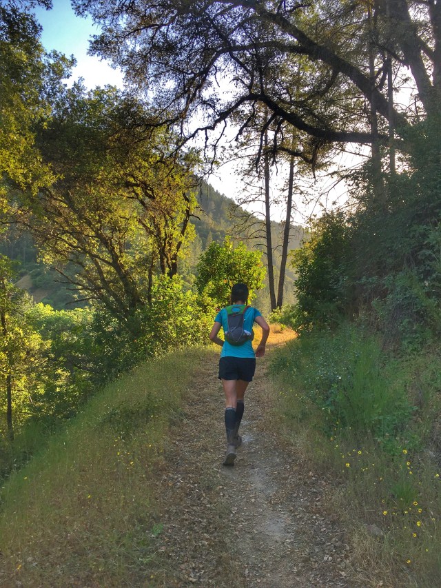
We headed out of Robinson Flat on the new course (as of 2017), following the fire road (43), which wasn’t clearly marked. Since we weren’t sure which way to go beforehand, Gretchen had printed out section maps from the Western States website, we had written instructions from Bill Rose, and got tips from Meghan on the drive.

We initially missed the first key right turn (around mile 4.5) and ended up at Mosquito Ridge Road, which we’d been told was a sign that we’d gone too far (very helpful tip!), so we backtracked and found a road marked 43 – 2, that we hoped was “Last Chance Road”. It was.

We followed this dirt road as it meandered further into the woods, passing straight through several intersections, until we found the WS Trail marker indicating the right turn onto the singletrack that would take us to Pucker Point (this trail can be missed if not looking for it- kind of a faint trail that goes downhill and to the right from the fire road, approx 200 meters after the Dusty Corners aid station (also not marked), and approximately 8 miles from the start in Robinson Flat, if you haven’t taken any wrong turns).
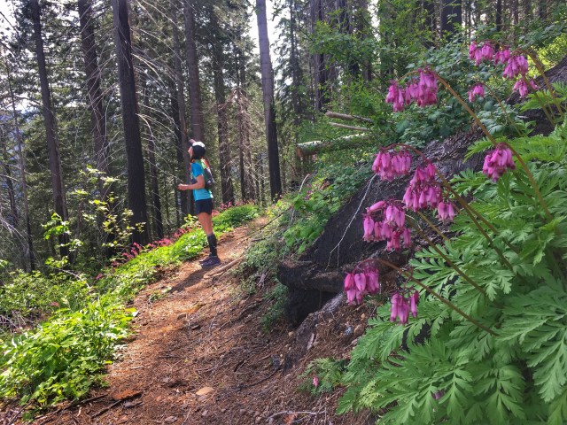
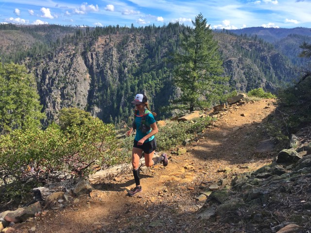
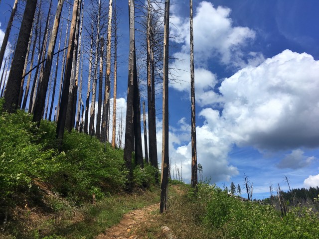
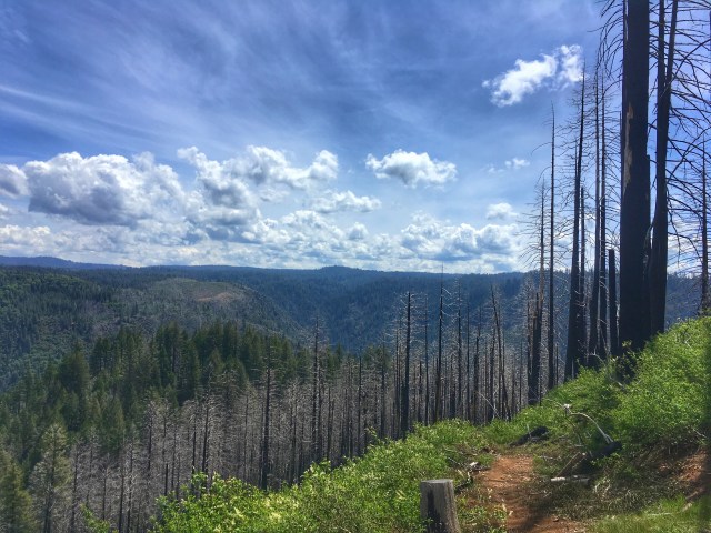
The scenery on this section is glorious; with great contrast between the charred trees from the forest fire and the new life creeping up – lush, green plants, vibrant wildflowers, and steep, sweeping views of the canyon with the river far below.

After about 4 miles on singletrack, we were back on fire roads through the Last Chance section of the course, a ghost town which happens to have a beautiful fresh water spring for refills, down to the left of the road in a little meadow (approx 14 miles from Robinson Flat).

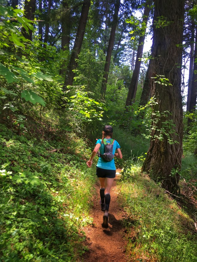
After passing through a gate we started down on singletrack towards the Swinging Bridge.

Gretchen excitedly filled me in on the sections where she had worked the previous Saturday, doing trail work with the Western States Trail Foundation. We marveled at how much work it takes just to keep these trails from disappearing.


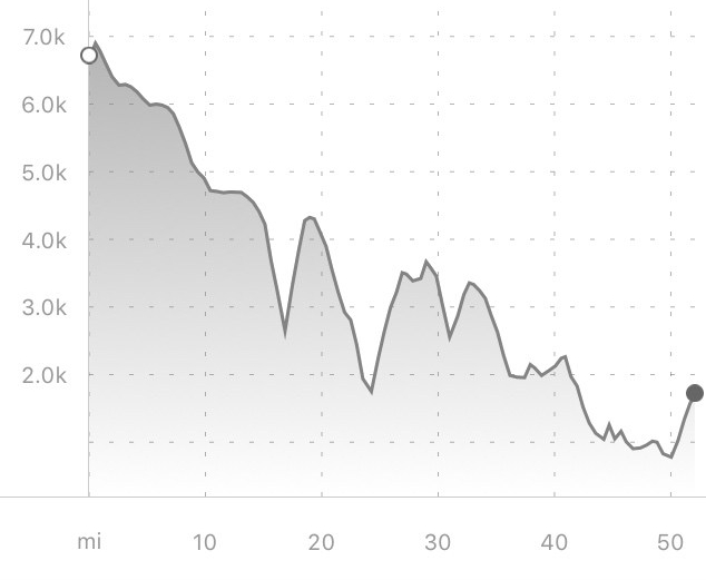
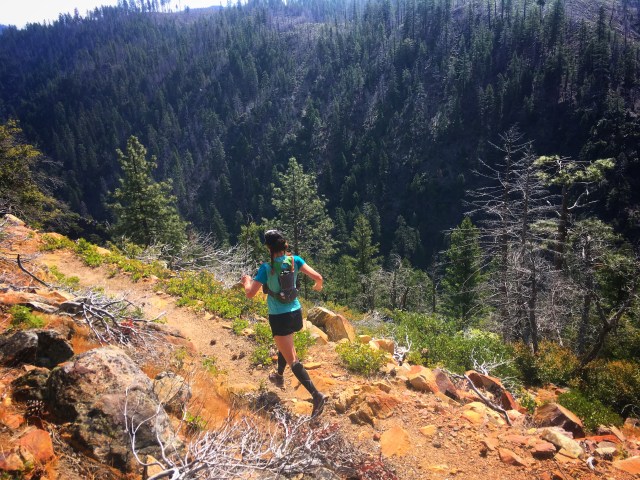
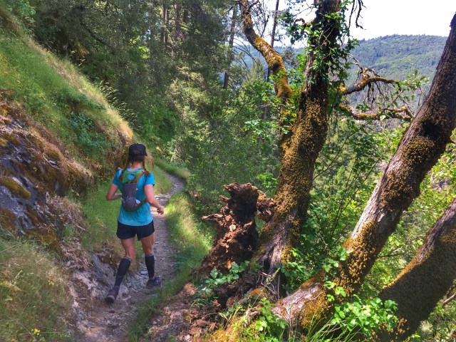
After reaching the bottom of our first canyon, at the Swinging Bridge, we began our first significant climb of the day, laughing that we’d only climbed 500′ in this first 16 miles. As we made our way up towards Devil’s Thumb I could fully appreciate the hard work of the trail crews over these past couple months – when I ran this section in March, the trail was barely passable in places due to all the downed trees and branches. On this beautiful day in May, there was hardly even a pinecone in the way. And the wildflowers were magical.


At the Devil’s Thumb (18 miles in), I sent a message to my boyfriend, Steve, letting him know our location, in the hopes that we would meet up with him in either Michigan Bluff or Foresthill, for a re-supply. We’d each carried enough food for 13 hours or so, and had a water filter, but fresh food and cold drinks on a long day would be so amazing, if it worked out.

We refilled our hydration packs at the Pump, which would carry us over until we hit Michigan Bluff. It was starting to feel a little hot.
As we headed down the singletrack towards Eldorado Creek, I got a text from Steve letting me know he’d be in Michigan Bluff with a cooler for us – hurray!
At the bottom of our second canyon, we stopped to cool off in Eldorado Creek before making the climb up to Michigan Bluff.
As promised, Steve was in the cute little town of Michigan Bluff with a spectacular spread of ice-cold drinks and freshly made sandwiches. With 27 miles in, it was a dream to have a soda and a sandwich. I filled my pack with coconut water and stuffed a ginger ale in for a treat later in the day. We were 6.5 hours in, and figured we had another 6 or so to go.


All was good leaving Michigan Bluff and descending into our third canyon, Volcano, until we were about 1/2 mile from the bottom and I took a flying, slow-motion crash/roll into the red dirt and rocks. I laid there until Gretchen arrived, not totally sure that I was ok.
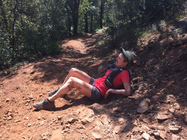

We still had over five hours remaining.
The top of my hamstring had been somewhat compromised in the fall, and as the tightness and pain set in, I doubted my ability to make it past Foresthill (33 miles). I took two Advil, cleaned myself up in Volcano Creek, and fought back tears. Stop in Foresthill? Or keep going and hope for the best?
As we ran up Bath Road towards the little town, I told Gretchen I couldn’t take a break here (earlier we’d discussed getting a cold drink), as I was afraid that I wouldn’t continue. We powered through Foresthill, and once we hit the left turn down Cal Street, and into our last canyon, I was committed. If anything, this would be good prep for States – learning that I can go on, even when my body says no. Slow down, pick up the feet, focus on good form, and remain upright. Oh, and check out the flowers, watch for poison oak, and have fun!

As the miles clicked by, I was filled with gratitude – how lucky I was, to have this entire beautiful day, an incredibly wonderful friend to share it with, and a caring boyfriend to meet us halfway. It was purely magical, and just what I needed, at this moment.

As we made our way along the river, Gretchen warned me that although it looked like we were almost done, the trail would take us back up and down a couple times before we finally hit Cal 3, Rucky Chucky.

When we reached the bottom (mile 50) I took a few minutes to fully submerge in the creek, before making our climb up to the Drivers Flat parking area. It’s amazing how much cleaner this can make you feel at the end of a 12 hour run!

Climbing up towards Drivers Flat, I was excited to be approaching the car, but kind of dreading the fact that we hadn’t packed any food or drinks for our finish. The thought of getting to the car and having to eat another energy bar and drink lukewarm water from my dirty hose was repulsive.
About a mile up, we heard a “woo-hoo!” – it was Steve and Bev! And they had cold drinks and fresh food!
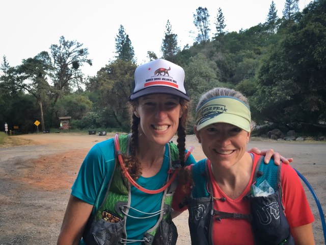
At the end of the day, we’d covered 52 miles, climbed 8500′ and descended 13,500′ in just over 12 hours. If Western States is anywhere near this enjoyable, I’m in for a treat.
