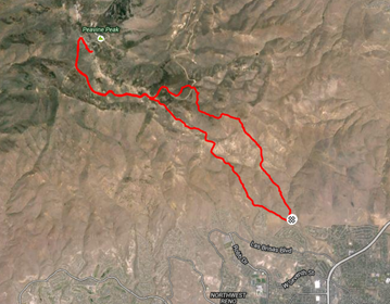
Early one dreary, cold January morning, Betsy and I headed down to Reno for a run up Peavine Mountain. There’s something unsettling about the area; it might be the discarded shotgun shells, the feeling that you’re being watched, rumors of mountain lion sightings; whatever it is, I’m always grateful to have a friend with me. Betsy, who will be running her 14th Hardrock 100 this July, prefers to make her own trail, in search of the steepest, most challenging 6 mile route up the 3,000’+ climb. “Hardrock training” she reminds me, as we struggle up and down the unforgiving and relentless terrain.
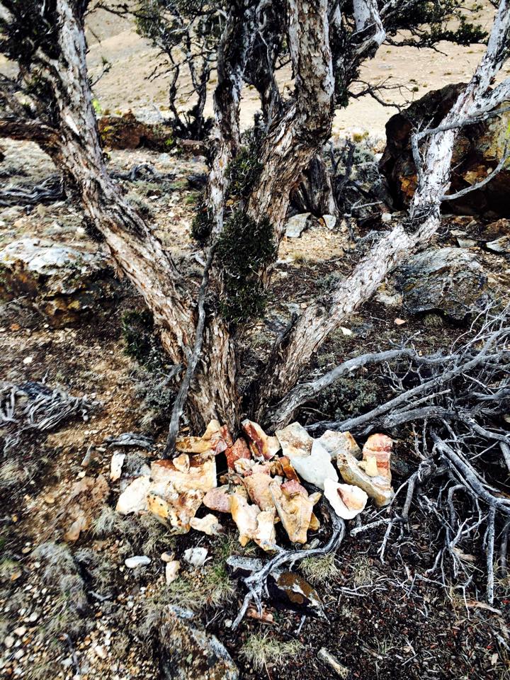
It’s pretty cold (in the 30s), but as we charge up and down the first couple climbs we quickly heat up and remove our jackets. Betsy hands me a heart-shaped rock to carry, which we later deposit at the heart rock sanctuary she has created over time.
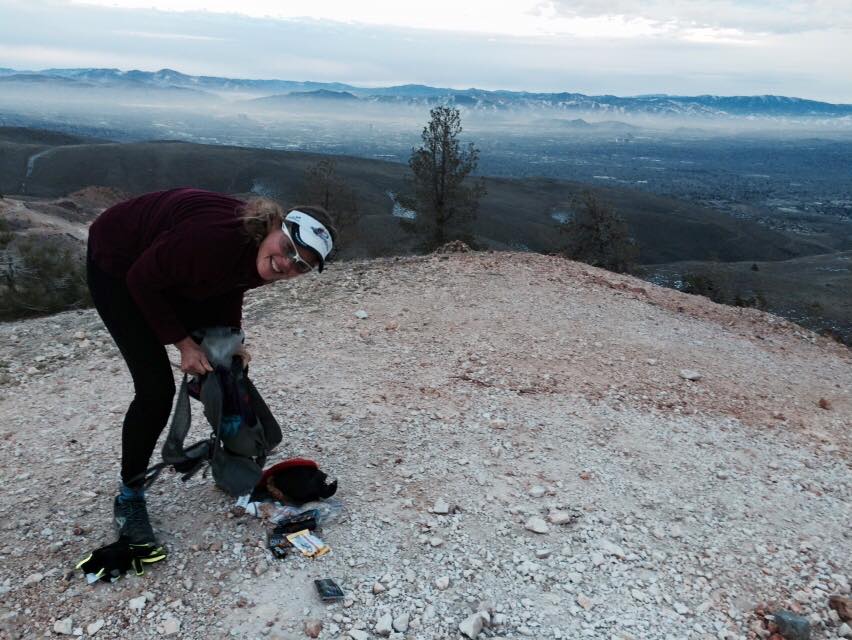
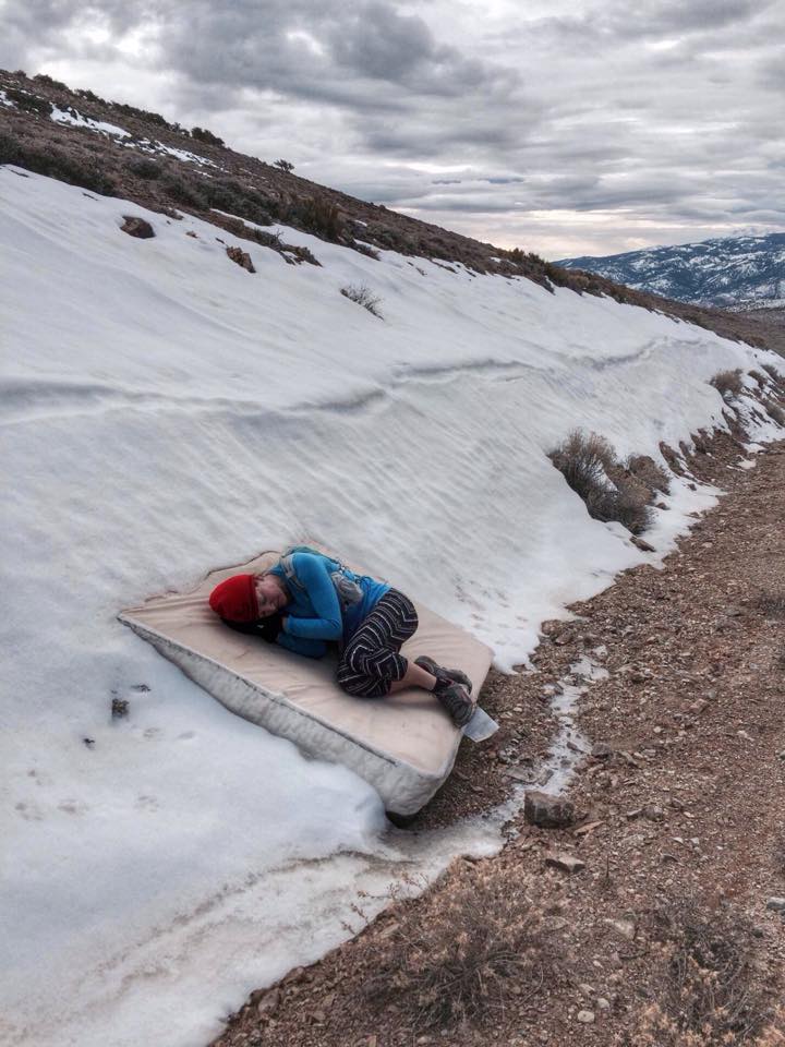
About midway, we stop so Betsy can adjust her monstrous pack and I reach for my phone to take her picture, and realize it’s not there. “that’s odd“, I mindlessly think, not fully coherent yet. We use her phone instead, and continue. Just below the summit, we find an old discarded mattress tucking out from under the snow. It fits in perfectly with the weirdness that is Peavine.

On the way down, we stick to the dirt roads and trails, as I need to race back to Truckee to volunteer for an Alpenglow Sports event at Alpine Meadows. Aside from Betsy puncturing her hydration pack bladder and losing all her water (the culprit- a pointy heart-shaped rock she had stuffed in her bag for “good luck”), the return trip is uneventful and Betsy decides she will call it a day.
We reach the cars, and I discover that I have, in fact, lost my phone (no insurance plan). I don’t have time to go back out and look for it, but my dearest most faithful friend Betsy decides this is a sign that she should go back out again (after already having determined on the way down, that puncturing her hydration bladder with a rock was a sign that she should call it a day).
We set up the Find My Iphone app on Betsy’s phone, log me in, and see a green dot on the map pinpointing my phone’s location. We determine from a nearby neighborhood on the map, that the phone was lost somewhere early on in the run, but as we were off-trail, actually finding it will prove difficult, and there is no way to measure the distance using the app.
I click on the “driving directions” icon, but now it gives us driving directions to a point 10 miles away – after some back-and-forth between the map and the “driving directions” tab, I decide this must be erroneous and tell Betsy I don’t think that part works, so just ignore it. The chances that someone had found my phone on the non-trail and already driven 10 miles away were nil.
I leave Betsy with my hydration bladder and she heads back out, while I race back to Truckee to get ready for the event. Once home, I call my boyfriend JP to let him know I lost my phone, and that Betsy was looking for it. I also call Betsy, who is still actively looking for my phone, but no luck so far.
Several hours later, at Alpine Meadows, out of contact with the world, I finally reach JP on someone else’s phone. While I was away, some crazy shit went down…
Betsy went all the way up and down Peavine Mountain again (using the “play sound” feature and calling my phone repeatedly), and did not find the phone. When she reached her car, she clicked on the “driving directions” tab, and decided that someone must have taken my phone, and driven away with it. And she was not giving up.
She followed the course, about 10 miles north, and was directed to a house in a remote area near Stead, Nevada. She decided it wasn’t safe for her to knock on the door and accuse the occupants of stealing my phone, so she called JP. JP, following Betsy’s lead, logged into the Find My Iphone app and driving directions, which led him 45 miles out to the same house.
JP cautiously approached the door, and was met by a gruff-looking man and his equally gruff-looking wife (or hostage) both dressed head to toe in camo. And it wasn’t hunting season. After trying to explain that the Find My Iphone app led him to their property, as the location of the missing phone, they both stared back at him- first with bewilderment, and then with anger. The man uttered “Get the fuck off my property. We don’t have your fucking phone.”
JP, true to his nature, wisely opened his mouth and said “It seems like you are hiding something?” More four-letter words followed from the man.
Having been booted off the property, our hero, decided to skirt the barb-wired fence, and the phone driving directions locator still showed the phone in the man’s yard “30 feet away” now “10 feet away”… The normally resourceful JP was at a loss of what to do, so he called up someone smarter then him. He called Betsy. She said “OMG! Call the fucking police on that guy! He stole it!”
Coincidentally, Grandpa Rambo did the same thing. Two hours later, Washoe County’s finest showed up, four of them, and the police intensively interviewed both parties. Ultimately, JP was granted 15 minutes of access to the back acreage, to search the property. Using both his Ipad, and his Iphone, under close supervision from the cops (“Where is it? Where’s the phone?” “Come on, where is it?“), the electronic device could not pinpoint the phone in the man’s yard. Nothing.
Meanwhile, back in Tahoe…
After the event at Alpine Meadows, I went home and uploaded my run data from my Suunto gps watch to Strava. I then took screenshots of both the satellite image of the run, and the satellite image from the Find My Iphone app (which still showed my phone in the original location, in the Peavine Mountain area).
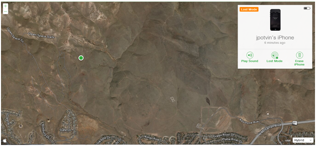
I studied the two maps, then used Strava to create a “route” so that I could pinpoint any spot along the route and get the exact mileage. Comparing this to the Find My Iphone satellite image, I estimated that the phone was dropped somewhere between .7 and .9 miles into the run.
The Find My Iphone app conveniently shows how much battery power is left on the missing phone, and I could tell that if we did not find my phone that night, the battery was going to die before we could get out there the next morning, so the “play a sound” feature would be useless, and we could no longer locate the phone, if someone moved it.
It was now after 6pm, but I felt that we still had a chance to find the phone (off trail, and in the dark), if we logged into Strava using JP’s iphone, and relied on the “route” feature to guide us, by keeping his phone on the “map view” page of the Strava app. I had once used this feature after getting lost on a new trail system in Copper Harbor, Michigan, so I knew it was possible to re-trace your steps. The app doesn’t warn you if you are going off-course, but you can follow a dot along the route and adjust your steps if you start veering in one direction or another.
JP, ever adventurous, after spending most of his afternoon in Stead with the camo couple and the Washoe County PD, agreed to my plan. We drove the 35 miles back to Reno, and after some shopping and dinner, we headed out to the Peavine Trailhead off of Kings Row, around 9pm.
I knew our chances were slim, but I couldn’t help feeling excited about the prospect of actually finding the phone, with the odds stacked against us. Betsy, who runs up there all the time, wasn’t able to find it in broad daylight. But I was fairly confident with my method, and had to have faith.
JP, who had mis-heard me at the house, thought I said the phone was “about 19 miles in” not “point 9 miles in”, and was highly confused when I insisted that my jeans, casual jacket, and no water bottle would be sufficient for our outing. He was quite relieved when I clarified how far we would be going.
JP brought his ipad, to use the “play sound” feature on the Find My Iphone app, so that we could keep his iphone on the Strava map page. I also had my Suunto watch tracking our route, so that I could see exactly how far we were into the hike, as I had estimated we would find the phone between .7 and .9 miles.
We started the route on Strava, and headed up the non-trail with our headlamps. I had never been to this area at night, and the views of the lights of Reno were pretty spectacular. It was beautiful, but a tad eerie, to be heading up Peavine at this hour.
The Strava route feature worked beautifully, and when my watch stated we were .6 miles in, we rotated between calling my phone, using the “play sound” feature, and shutting off our headlamps to see if we could see a screen light up.
.7 miles. nothing.
.8 miles. nothing.
Just shy of .9 miles, we heard a beeping sound. Woo-hoo!! We began racing towards the sound, to see who could find it first. Headlamp on, headlamp off, looking for the light. Nothing. After a two-minute chase, we started to hear the sound behind us. Oh no, are we just hearing an echo off the surrounding hills?? Where is it? JP backtracked slightly, and found the phone. We had walked right over it, but it was screen-down. I dusted it off, and it was in perfect condition.
So, thank you, JP; thank you, Betsy; thank you, camouflage man, for not shooting my boyfriend; thank you, Washoe County PD, and thank you, Strava, for saving me $650 on a new iphone.
My guess on the reason for the driving directions fail: with no GPS coordinates, the pin just searches for the nearest street address. Since the nearest address was more than a mile away, the driving directions just seemed to drop a pin in the middle of the zipcode. If we had the GPS coordinates, we probably could have found the phone without Strava. But given the circumstances, Strava saved the day.

Beautifully written. 👍👏❤️
LikeLike
Amazing determination. Glad you found your expensive phone and no one got hurt…like JP!
LikeLike
Thanks, Jean! That was such a crazy experience. 🙂
LikeLike